SpectraSelectionMethods
Intelligently leveraging CSIRO’s large national soil spectral library resource - Methods of spectral selection
The C4S platform embeds a range of Spectral selection methods that allow users to identify and extract relevant spectra from large national or project-level libraries to improve the calibration model building of local datasets. At present four selection algorithms are available in the platform.
The last two approaches mentioned below (c and d) were largely integrated as proof of concept approaches to demonstrate how integration of spatial datasets with C4S allows for localisation informed by geographic closeness or soil formation similarity, and to build the platform’s system requirements to automate the process. The second approach (b) is similar to a spectrum-based learning approach that should find the best possible spectra from the national library if the local data are represented in the library.
a. Latent Variable Convex Hull Approach (Islam et al., 2005) – identifies samples that define the convex hull in a latent variable space, ensuring that selected spectra capture the full range of spectral diversity (Figure 1).
b. Count of Observations (CoObs) Approach (Malone et al., 2019) – identifies nearest neighbours in a latent variable space to prioritize samples most similar to user-supplied spectra while penalizing redundancy (Figure 2).
c. Geographic Distance Approach – selects spectra based on spatial proximity to user project sites, assuming some degree of spatial correlation in soil properties (Figure 3).
d. Australian Soil Classification (ASC) Approach – filters spectra according to Australian Soil Classification groupings (Searle, 2021), constraining the selection to comparable soil types (Figure 4).
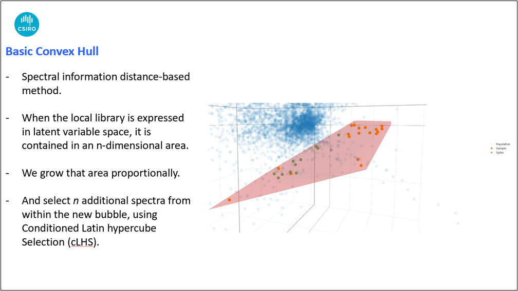
Figure 1. Basic Latent Variable Convex Hull Soil Spectral Selection Approach.
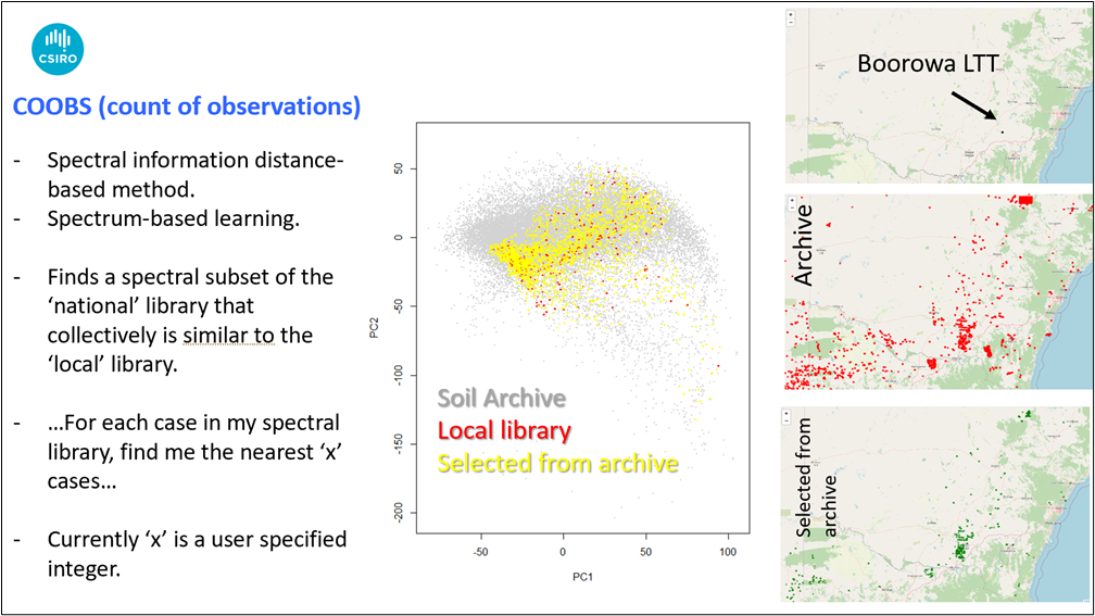
Figure 2. Count of Observations (CoObs) Spectral Selection Approach.
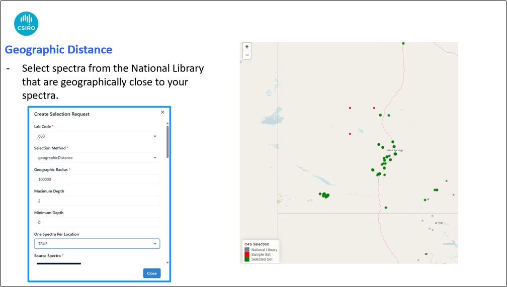
Figure 3. Geographic Distance Soil Spectral Selection Approach.
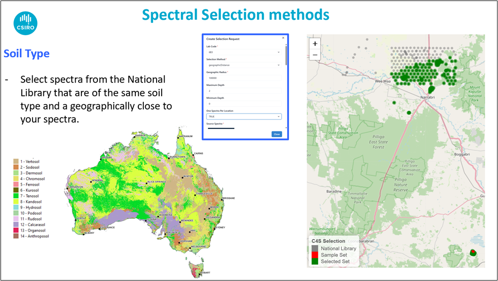
Figure 4. Australian Soil Classification (ASC) Soil Spectral Selection Approach.
References:
Islam K, McBratney A, Singh B (2005) Rapid estimation of soil variability from the convex hull biplot area of topsoil ultra-violet, visible and near-infrared diffuse reflectance spectra. Geoderma, 128(3), 249-257.
Malone BP, Minasny B, Brungard C (2019) Some methods to improve the utility of conditioned Latin hypercube sampling. PeerJ, 7, e6451.
Moloney JP, Searle R, Malone BP, Dino A, Karunaratne S, Benn D, Stockmann U (2026) The Soil Spectral Selection System: A Practical Platform to operationalise Soil Spectroscopy. Computers and Electronics in Agriculture. Submitted.
Searle R (2021) Soil and Landscape Grid National Soil Attribute Maps - Australian Soil Classification Map (3” resolution) - Release 1. v4. CSIRO. Data Collection. https://doi.org/10.25919/vkjn-3013.
Stockmann U, Moloney J, Searle R, Dino A, Malone B, Karunaratne S, Benn D, Glover M, Zhao T (2025) Australia’s national soil spectral library empowering rapid Soil Organic Carbon measurement. End of Project Outcomes Summary Report. Department of Climate Change, Energy, the Environment and Water (DCCEEW) National Soil Carbon Innovation Challenge (NSCIC) Development and Demonstration Grant Round 2 Project SCICDDII000042. CSIRO, Australia.