Ingest Spectra
Now that you have created a Project it is time to add sites and the soil spectral scans for those sites to the Project. There may be numerous spectral scans at the same site either at the same depth or differing depths.
Currently C4S recognises these spectral file formats:
- Nicolet_spa
- Thermo_spc
- Bruker_opus_binary
- ASD_binary_format
- ASD_sco_binary
- Perkin_elmer
- CSV
- Hone_labred
- SCANS
- Spectral Evolution
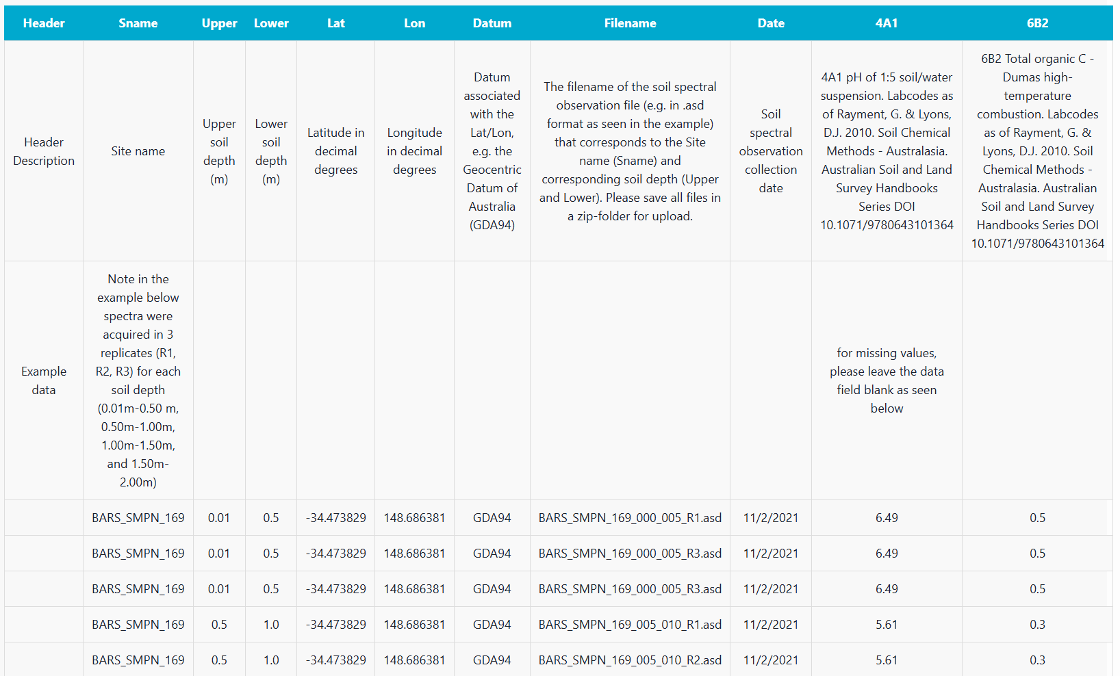
Sites can be added to a Project individually, but in the majority of cases they will be entered in bulk using a csv template that captures the site name, upper sample depth, lower sample depth, latitude, longitude, datum, date and the filename for each individual spectra corresponding to the sampling depths.
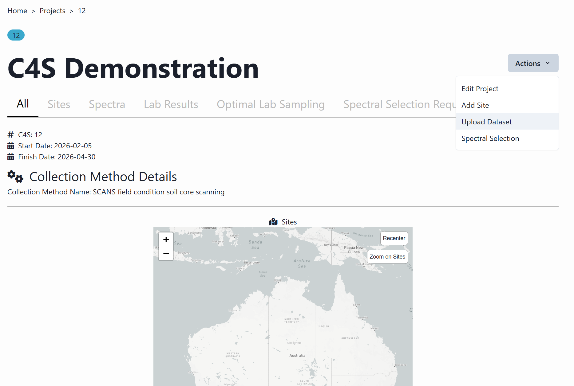
The “Dataset Upload” page can be accessed via the Menu in the upper right corner of the app as shown below.
Now you can upload your soil dataset here in 3 quick steps!
First, prepare the ingest template for the C4S reader to understand the data. Each record in the csv file should be filled in with the relevant information for each spectra. The template should contain these field names at a minimum :-
- Sname: Site name
- Upper: Upper sample depth
- Lower: Lower sample depth
- Lat: Latitude
- Lon: Longitude
- Datum: Datum (e.g., WGS84)
- Filename: Name of the spectra file
- Date: Date of the spectra collection
Measured laboratory data can also be added to columns next to these. The field name for each laboratory method to be entered is given by using a standard “Green Book” code (Rayment, G.E. & D.J. Lyons (2011). Soil Chemical Methods – Australasia. CSIRO Publishing).
Next, compress all spectra files mentioned in the csv file should be added to a zip file inside a single folder.
Next, upload the zip file and the csv file by dragging the files into the grey box at the bottom of the Data Upload page.
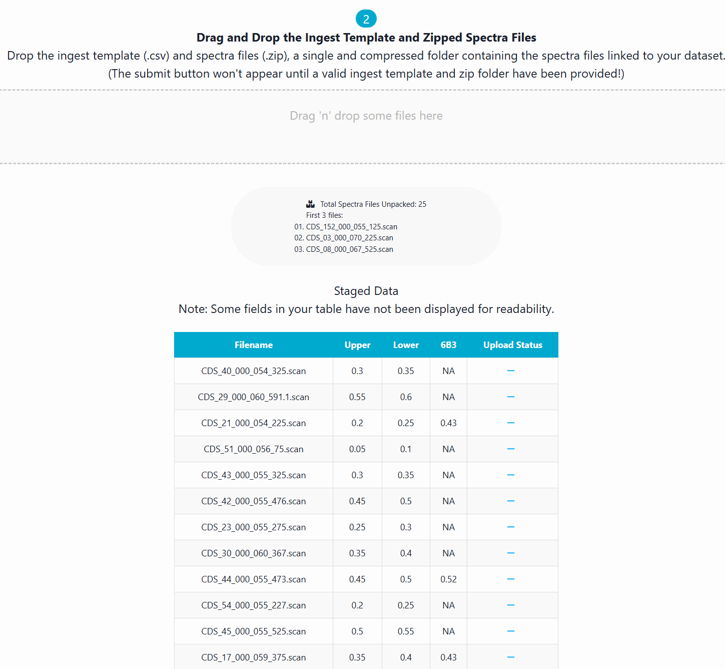
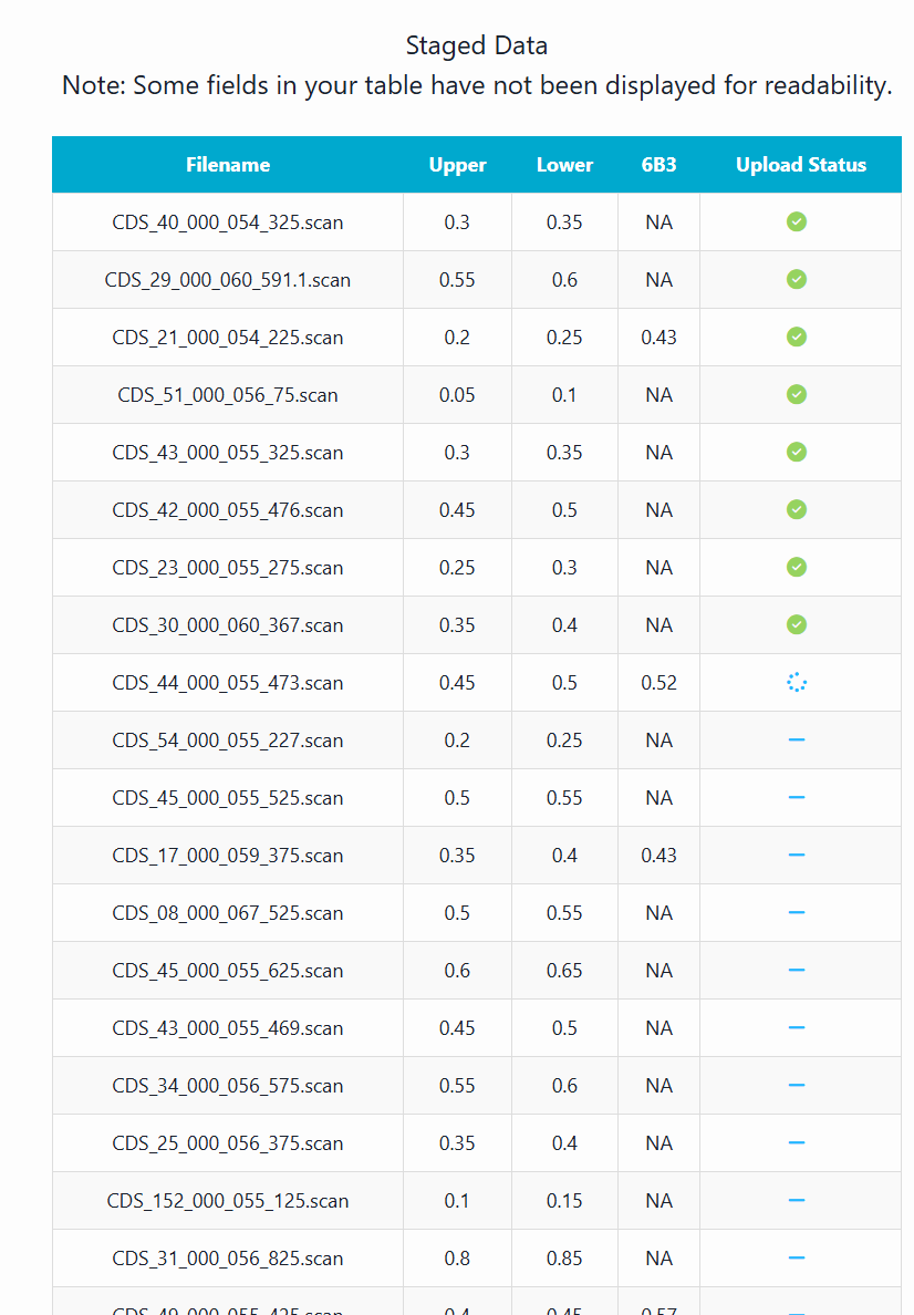
Finally, click submit and C4S will process the files and add them to your Project. A green tick will appear next to each spectral record when it has been successfully ingested into the C4S system.