30m Covariates
SLGA Cloud Optimised GeoTiff DataStore Home
The datasets listed here comprise the TERN national 30m Digital Soil Modelling (DSM) raster environmental covariate stack. They are stored as Cloud Optimised Geotiffs (COGs). You can download them from here or access them directly from here using you favourite COGs viewer - ours is QGIS. Click on the left most icon to view an enlarged image for the dataset. Click on the "Copy URL" to copy the URL of the data set into the computer clipboard for pasting into you viewer. Click on the name link to download the whole dataset and hover over the "I" icon to see extended metadata.
Click on the sections below to show the URLs for the Cloud Optimised GeoTIFFS.
 Click to enlarge the image
|
|
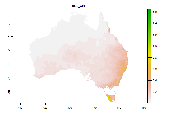
16.5 Gb | Clim_ADI |

Name : Clim_ADI
Description : Minimum monthly aridity index
Source : CSIRO
Metadata : https://shiny.esoil.io/Apps/Covariates?Attribute=Climate&Name=Clim_ADI&Resolution=30m
Units : index
SCORPAN : Climate
Original Resolution : 90m
|
Minimum monthly aridity index | MetaData |
 Click to enlarge the image
|
|
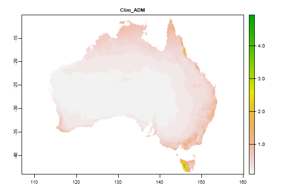
16.1 Gb | Clim_ADM |
Name : Clim_ADM
Description : Mean annual aridity index (annual precipitation/ annual potential evaporation)
Source : CSIRO
Metadata : https://shiny.esoil.io/Apps/Covariates?Attribute=Climate&Name=Clim_ADM&Resolution=30m
Units : index
SCORPAN : Climate
Original Resolution : 90m
|
Mean annual aridity index (annual precipitation/ annual potential evaporation) | MetaData |
 Click to enlarge the image
|
|
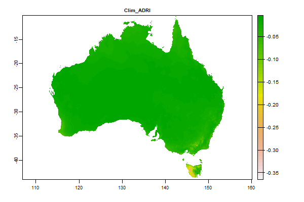
16.4 Gb | Clim_ADRI |
Name : Clim_ADRI
Description : Aridity Index (PT/EP) - min difference between successive months
Source : CSIRO
Metadata : https://shiny.esoil.io/Apps/Covariates?Attribute=Climate&Name=Clim_ADRI&Resolution=30m
Units : index
SCORPAN : Climate
Original Resolution : 90m
|
Aridity Index (PT/EP) - min difference between successive months | MetaData |
 Click to enlarge the image
|
|
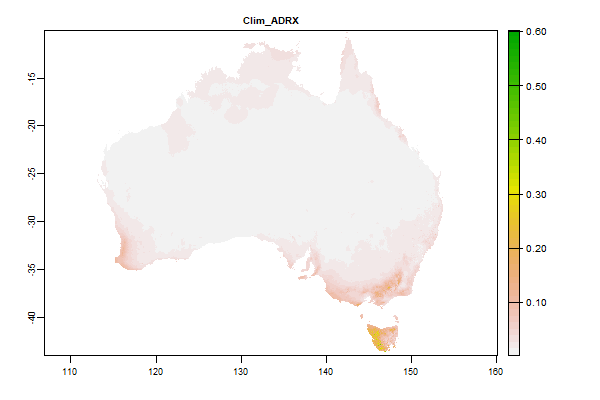
16.7 Gb | Clim_ADRX |
Name : Clim_ADRX
Description : Aridity Index (PT/EP)- max difference between successive months
Source : CSIRO
Metadata : https://shiny.esoil.io/Apps/Covariates?Attribute=Climate&Name=Clim_ADRX&Resolution=30m
Units : index
SCORPAN : Climate
Original Resolution : 90m
|
Aridity Index (PT/EP)- max difference between successive months | MetaData |
 Click to enlarge the image
|
|
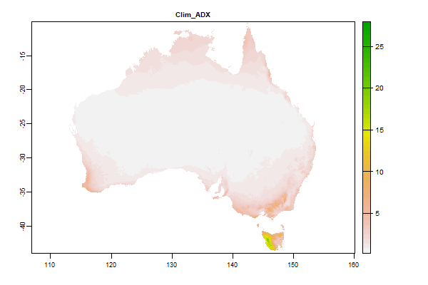
16.3 Gb | Clim_ADX |
Name : Clim_ADX
Description : Aridity Index (PT/EP)- max difference between successive months
Source : CSIRO
Metadata : https://shiny.esoil.io/Apps/Covariates?Attribute=Climate&Name=Clim_ADX&Resolution=30m
Units : index
SCORPAN : Climate
Original Resolution : 90m
|
Aridity Index (PT/EP)- max difference between successive months | MetaData |
 Click to enlarge the image
|
|
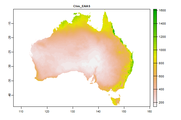
14.2 Gb | Clim_EAAS |
Name : Clim_EAAS
Description : Annual total actual evapotranspiration modelled using terrain-scaled water holding capacity (mm)
Source : CSIRO
Metadata : https://shiny.esoil.io/Apps/Covariates?Attribute=Climate&Name=Clim_EAAS&Resolution=30m
Units : mm
SCORPAN : Climate
Original Resolution : 90m
|
Annual total actual evapotranspiration modelled using terrain-scaled water holding capacity (mm) | MetaData |
 Click to enlarge the image
|
|
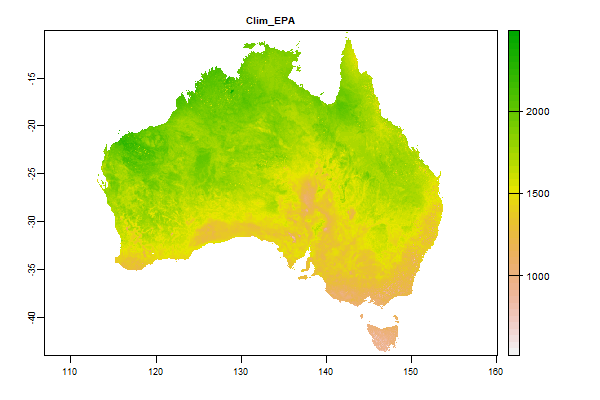
25.1 Gb | Clim_EPA |
Name : Clim_EPA
Description : Annual potential evaporation (mm)
Source : CSIRO
Metadata : https://shiny.esoil.io/Apps/Covariates?Attribute=Climate&Name=Clim_EPA&Resolution=30m
Units : mm
SCORPAN : Climate
Original Resolution : 90m
|
Annual potential evaporation (mm) | MetaData |
 Click to enlarge the image
|
|
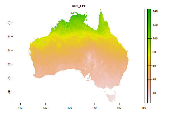
16.9 Gb | Clim_EPI |
Name : Clim_EPI
Description : Minimum monthly potential evaporation (mm)
Source : CSIRO
Metadata : https://shiny.esoil.io/Apps/Covariates?Attribute=Climate&Name=Clim_EPI&Resolution=30m
Units : mm
SCORPAN : Climate
Original Resolution : 90m
|
Minimum monthly potential evaporation (mm) | MetaData |
 Click to enlarge the image
|
|
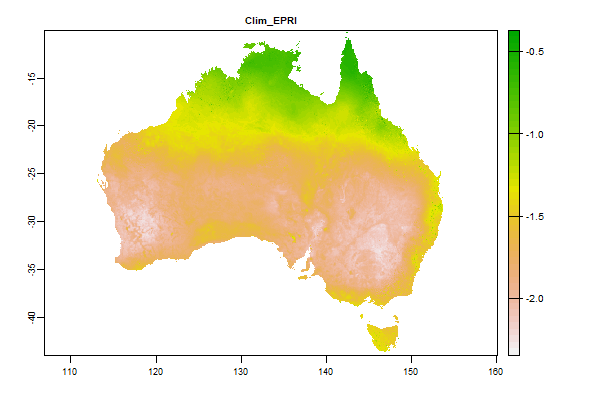
15.5 Gb | Clim_EPRI |
Name : Clim_EPRI
Description : Potential evaporation - min difference between successive months
Source : CSIRO
Metadata : https://shiny.esoil.io/Apps/Covariates?Attribute=Climate&Name=Clim_EPRI&Resolution=30m
Units : mm
SCORPAN : Climate
Original Resolution : 90m
|
Potential evaporation - min difference between successive months | MetaData |
 Click to enlarge the image
|
|
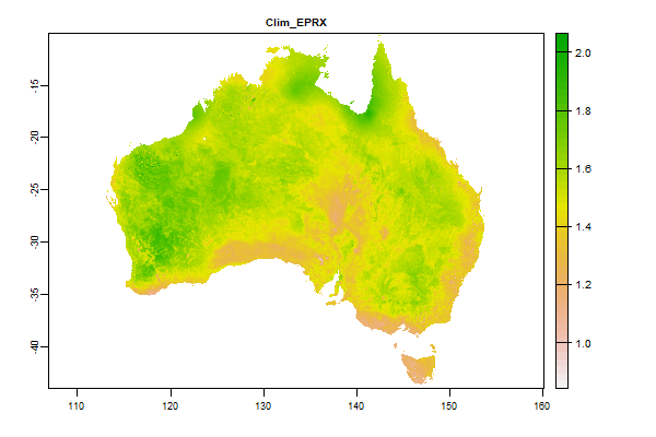
15.6 Gb | Clim_EPRX |
Name : Clim_EPRX
Description : Potential evaporation - max difference between successive months
Source : CSIRO
Metadata : https://shiny.esoil.io/Apps/Covariates?Attribute=Climate&Name=Clim_EPRX&Resolution=30m
Units : mm
SCORPAN : Climate
Original Resolution : 90m
|
Potential evaporation - max difference between successive months | MetaData |
 Click to enlarge the image
|
|
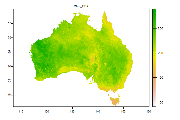
15 Gb | Clim_EPX |
Name : Clim_EPX
Description : Maximum monthly potential evaporation (mm)
Source : CSIRO
Metadata : https://shiny.esoil.io/Apps/Covariates?Attribute=Climate&Name=Clim_EPX&Resolution=30m
Units : mm
SCORPAN : Climate
Original Resolution : 90m
|
Maximum monthly potential evaporation (mm) | MetaData |
 Click to enlarge the image
|
|
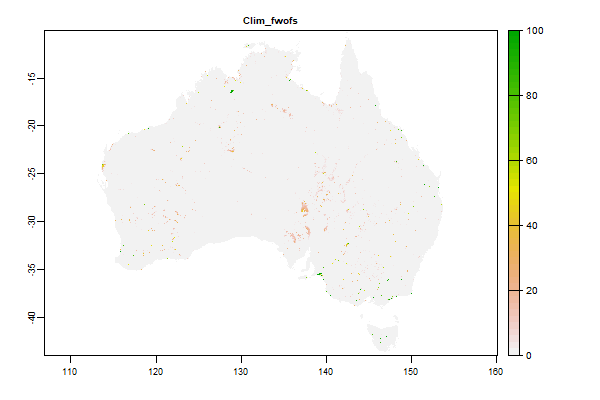
6 Gb | Clim_fwofs |
Name : Clim_fwofs
Description : WaterObservations from Space FRESHWATER(Split Fresh/Salt to deal with coastal systems)
Source : CSIRO
Metadata : https://shiny.esoil.io/Apps/Covariates?Attribute=Climate&Name=Clim_fwofs&Resolution=30m
Units : percent
SCORPAN : Climate
Original Resolution : 90m
|
WaterObservations from Space FRESHWATER(Split Fresh/Salt to deal with coastal systems) | MetaData |
 Click to enlarge the image
|
|
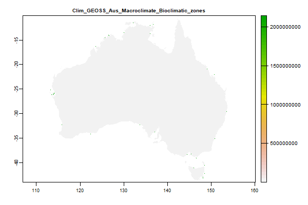
548.7 Mb | Clim_GEOSS_Aus_Macroclimate_Bioclimatic_zones |
Name : Clim_GEOSS_Aus_Macroclimate_Bioclimatic_zones
Description : GEOSS Ecosystem Mapping for Australia - Macroclimate Bioclimatic zones
Source : TERN
Metadata : https://shiny.esoil.io/Apps/Covariates?Attribute=Climate&Name=Clim_GEOSS_Aus_Macroclimate_Bioclimatic_zones&Resolution=30m
Units : none
SCORPAN : Climate
Original Resolution : 90m
|
GEOSS Ecosystem Mapping for Australia - Macroclimate Bioclimatic zones | MetaData |
 Click to enlarge the image
|
|
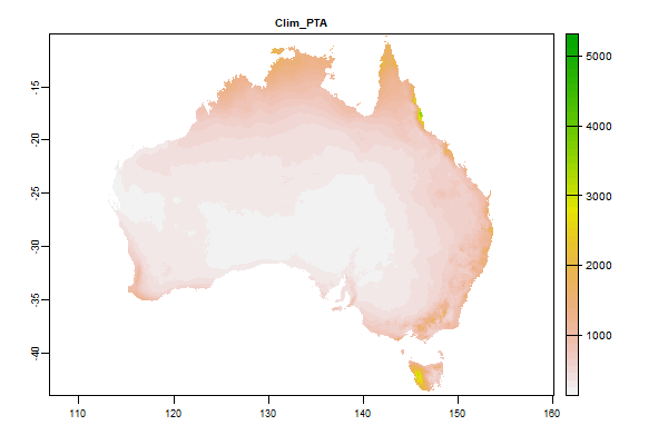
13.6 Gb | Clim_PTA |
Name : Clim_PTA
Description : Annual precipitation (mm)
Source : CSIRO
Metadata : https://shiny.esoil.io/Apps/Covariates?Attribute=Climate&Name=Clim_PTA&Resolution=30m
Units : mm
SCORPAN : Climate
Original Resolution : 90m
|
Annual precipitation (mm) | MetaData |
 Click to enlarge the image
|
|
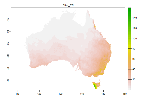
15.4 Gb | Clim_PTI |
Name : Clim_PTI
Description : Minimum monthly precipitation (mm)
Source : CSIRO
Metadata : https://shiny.esoil.io/Apps/Covariates?Attribute=Climate&Name=Clim_PTI&Resolution=30m
Units : mm
SCORPAN : Climate
Original Resolution : 90m
|
Minimum monthly precipitation (mm) | MetaData |
 Click to enlarge the image
|
|
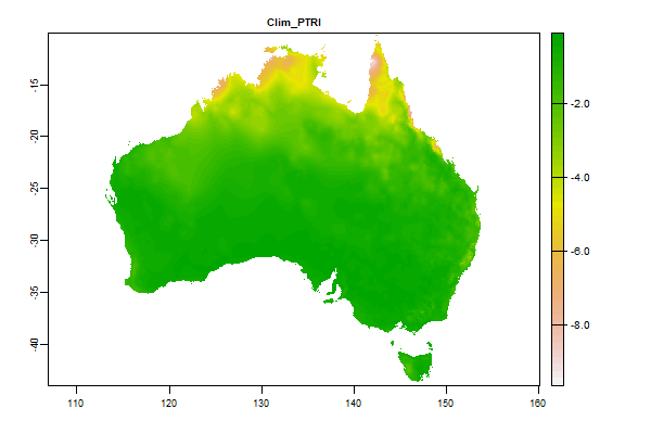
13.5 Gb | Clim_PTRI |
Name : Clim_PTRI
Description : Precipitation seasonality � minimum of differences between successive months
Source : CSIRO
Metadata : https://shiny.esoil.io/Apps/Covariates?Attribute=Climate&Name=Clim_PTRI&Resolution=30m
Units : mm/day
SCORPAN : Climate
Original Resolution : 90m
|
Precipitation seasonality � minimum of differences between successive months | MetaData |
 Click to enlarge the image
|
|
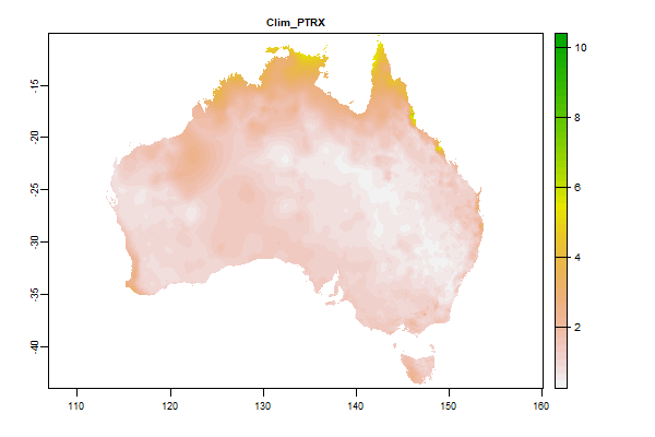
13.4 Gb | Clim_PTRX |
Name : Clim_PTRX
Description : Precipitation seasonality � maximum of differences between successive months
Source : CSIRO
Metadata : https://shiny.esoil.io/Apps/Covariates?Attribute=Climate&Name=Clim_PTRX&Resolution=30m
Units : mm/day
SCORPAN : Climate
Original Resolution : 90m
|
Precipitation seasonality � maximum of differences between successive months | MetaData |
 Click to enlarge the image
|
|
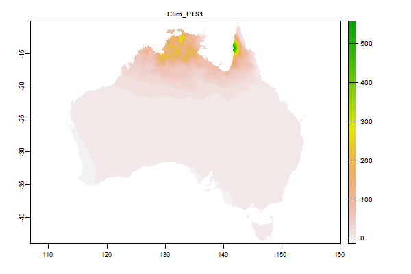
14.8 Gb | Clim_PTS1 |
Name : Clim_PTS1
Description : Precipitation seasonality 1- solstice seasonality composite factor ratio
Source : CSIRO
Metadata : https://shiny.esoil.io/Apps/Covariates?Attribute=Climate&Name=Clim_PTS1&Resolution=30m
Units : ratio
SCORPAN : Climate
Original Resolution : 90m
|
Precipitation seasonality 1- solstice seasonality composite factor ratio | MetaData |
 Click to enlarge the image
|
|
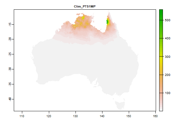
14.4 Gb | Clim_PTS1MP |
Name : Clim_PTS1MP
Description : Precipitation - solstice seasonality ratio alternative
Source : CSIRO
Metadata : https://shiny.esoil.io/Apps/Covariates?Attribute=Climate&Name=Clim_PTS1MP&Resolution=30m
Units : ratio
SCORPAN : Climate
Original Resolution : 90m
|
Precipitation - solstice seasonality ratio alternative | MetaData |
 Click to enlarge the image
|
|
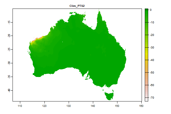
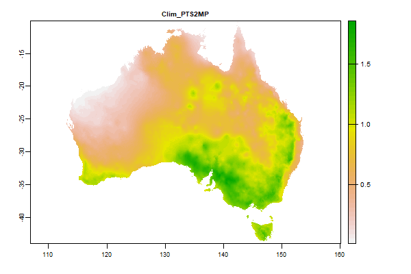
25.1 Gb | Clim_PTS2 |
Name : Clim_PTS2
Description : Precipitation seasonality 2- equinox seasonality composite factor ratio
Source : CSIRO
Metadata : https://shiny.esoil.io/Apps/Covariates?Attribute=Climate&Name=Clim_PTS2&Resolution=30m
Units : ratio
SCORPAN : Climate
Original Resolution : 90m
|
Precipitation seasonality 2- equinox seasonality composite factor ratio | MetaData |
 Click to enlarge the image
|
|
13.3 Gb | Clim_PTS2MP |
Name : Clim_PTS2MP
Description : Precipitation - equinox seasonality ratio alternative
Source : CSIRO
Metadata : https://shiny.esoil.io/Apps/Covariates?Attribute=Climate&Name=Clim_PTS2MP&Resolution=30m
Units : ratio
SCORPAN : Climate
Original Resolution : 90m
|
Precipitation - equinox seasonality ratio alternative | MetaData |
 Click to enlarge the image
|
|
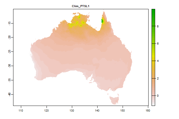
13.3 Gb | Clim_PTSL1 |
Name : Clim_PTSL1
Description : Log Precip Seasonality 1
Source : CSIRO
Metadata : https://shiny.esoil.io/Apps/Covariates?Attribute=Climate&Name=Clim_PTSL1&Resolution=30m
Units : none
SCORPAN : Climate
Original Resolution : 90m
|
Log Precip Seasonality 1 | MetaData |
 Click to enlarge the image
|
|
12.2 Gb | Clim_PTSL2 |
Name : Clim_PTSL2
Description : Log Precip Seasonality 2
Source : CSIRO
Metadata : https://shiny.esoil.io/Apps/Covariates?Attribute=Climate&Name=Clim_PTSL2&Resolution=30m
Units : none
SCORPAN : Climate
Original Resolution : 90m
|
Log Precip Seasonality 2 | MetaData |
 Click to enlarge the image
|
|
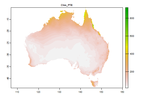
25 Gb | Clim_PTX |
Name : Clim_PTX
Description : Maximum monthly precipitation (mm)
Source : CSIRO
Metadata : https://shiny.esoil.io/Apps/Covariates?Attribute=Climate&Name=Clim_PTX&Resolution=30m
Units : mm
SCORPAN : Climate
Original Resolution : 90m
|
Maximum monthly precipitation (mm) | MetaData |
 Click to enlarge the image
|
|
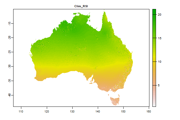
17.7 Gb | Clim_RSI |
Name : Clim_RSI
Description : Short-wave solar radiation - monthly minimum (SRAD data)
Source : CSIRO
Metadata : https://shiny.esoil.io/Apps/Covariates?Attribute=Climate&Name=Clim_RSI&Resolution=30m
Units : MJ/m2/day
SCORPAN : Climate
Original Resolution : 90m
|
Short-wave solar radiation - monthly minimum (SRAD data) | MetaData |
 Click to enlarge the image
|
|
16.1 Gb | Clim_RSM |
Name : Clim_RSM
Description : Short-wave solar radiation - annual mean (SRAD data)
Source : CSIRO
Metadata : https://shiny.esoil.io/Apps/Covariates?Attribute=Climate&Name=Clim_RSM&Resolution=30m
Units : MJ/m2/day
SCORPAN : Climate
Original Resolution : 90m
|
Short-wave solar radiation - annual mean (SRAD data) | MetaData |
 Click to enlarge the image
|
|
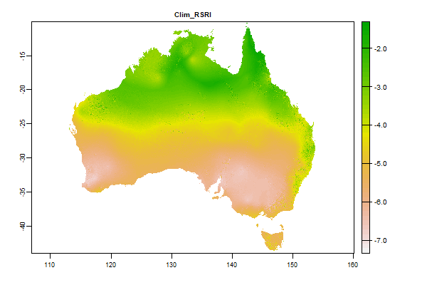
17.1 Gb | Clim_RSRI |
Name : Clim_RSRI
Description : Short-wave solar radiation - min difference between successive months(SRAD data)
Source : CSIRO
Metadata : https://shiny.esoil.io/Apps/Covariates?Attribute=Climate&Name=Clim_RSRI&Resolution=30m
Units : MJ/m2/day
SCORPAN : Climate
Original Resolution : 90m
|
Short-wave solar radiation - min difference between successive months(SRAD data) | MetaData |
 Click to enlarge the image
|
|
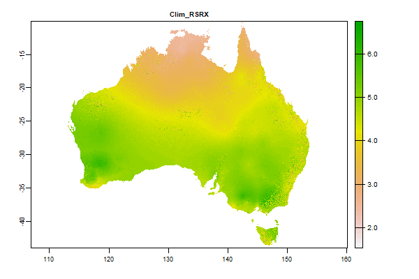
17 Gb | Clim_RSRX |
Name : Clim_RSRX
Description : Short-wave solar radiation - max difference between successive months(SRAD data)
Source : CSIRO
Metadata : https://shiny.esoil.io/Apps/Covariates?Attribute=Climate&Name=Clim_RSRX&Resolution=30m
Units : MJ/m2/day
SCORPAN : Climate
Original Resolution : 90m
|
Short-wave solar radiation - max difference between successive months(SRAD data) | MetaData |
 Click to enlarge the image
|
|
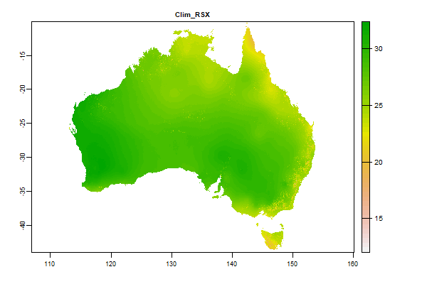
14.6 Gb | Clim_RSX |
Name : Clim_RSX
Description : Short-wave solar radiation - max difference between successive months(SRAD data)
Source : CSIRO
Metadata : https://shiny.esoil.io/Apps/Covariates?Attribute=Climate&Name=Clim_RSX&Resolution=30m
Units : MJ/m2/day
SCORPAN : Climate
Original Resolution : 90m
|
Short-wave solar radiation - max difference between successive months(SRAD data) | MetaData |
 Click to enlarge the image
|
|
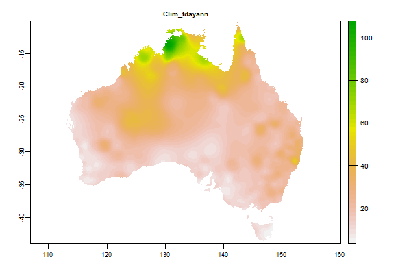
3.6 Gb | Clim_tdayann |
Name : Clim_tdayann
Description : Average thunder days - Annual
Source : BOM
Metadata : https://shiny.esoil.io/Apps/Covariates?Attribute=Climate&Name=Clim_tdayann&Resolution=30m
Units : percent
SCORPAN : Climate
Original Resolution : 5km
|
Average thunder days - Annual | MetaData |
 Click to enlarge the image
|
|
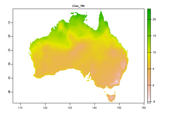
13.2 Gb | Clim_TNI |
Name : Clim_TNI
Description : Minimum temperature - monthly minimum (�C)
Source : CSIRO
Metadata : https://shiny.esoil.io/Apps/Covariates?Attribute=Climate&Name=Clim_TNI&Resolution=30m
Units : degrees celcius
SCORPAN : Climate
Original Resolution : 90m
|
Minimum temperature - monthly minimum (�C) | MetaData |
 Click to enlarge the image
|
|
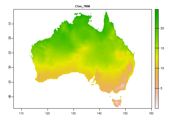
12.3 Gb | Clim_TNM |
Name : Clim_TNM
Description : Minimum temperature � Annual mean (�C)
Source : CSIRO
Metadata : https://shiny.esoil.io/Apps/Covariates?Attribute=Climate&Name=Clim_TNM&Resolution=30m
Units : degrees celcius
SCORPAN : Climate
Original Resolution : 90m
|
Minimum temperature � Annual mean (�C) | MetaData |
 Click to enlarge the image
|
|
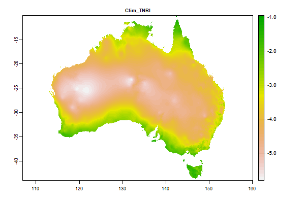
11.8 Gb | Clim_TNRI |
Name : Clim_TNRI
Description : Temperature - min difference in min between successive months
Source : CSIRO
Metadata : https://shiny.esoil.io/Apps/Covariates?Attribute=Climate&Name=Clim_TNRI&Resolution=30m
Units : degrees celcius per day
SCORPAN : Climate
Original Resolution : 90m
|
Temperature - min difference in min between successive months | MetaData |
 Click to enlarge the image
|
|
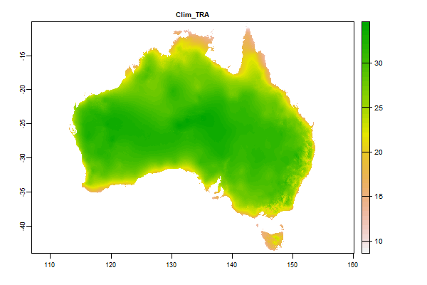
13.4 Gb | Clim_TRA |
Name : Clim_TRA
Description : Annual temperature range (TXX � TNI) (�C)
Source : CSIRO
Metadata : https://shiny.esoil.io/Apps/Covariates?Attribute=Climate&Name=Clim_TRA&Resolution=30m
Units : degrees celcius
SCORPAN : Climate
Original Resolution : 90m
|
Annual temperature range (TXX � TNI) (�C) | MetaData |
 Click to enlarge the image
|
|
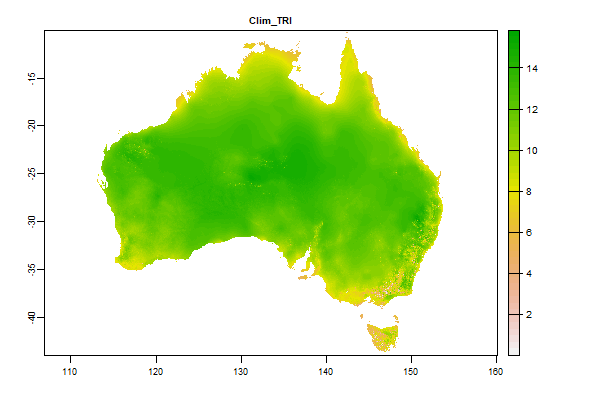
14.9 Gb | Clim_TRI |
Name : Clim_TRI
Description : Minimum monthly mean diurnal temperature range (�C)
Source : CSIRO
Metadata : https://shiny.esoil.io/Apps/Covariates?Attribute=Climate&Name=Clim_TRI&Resolution=30m
Units : degrees celcius
SCORPAN : Climate
Original Resolution : 90m
|
Minimum monthly mean diurnal temperature range (�C) | MetaData |
 Click to enlarge the image
|
|
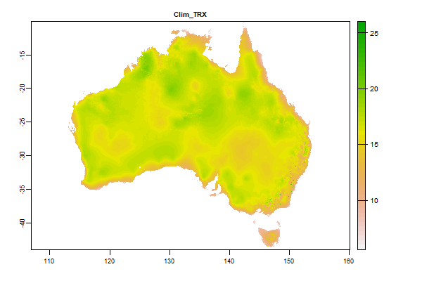
14.2 Gb | Clim_TRX |
Name : Clim_TRX
Description : Maximum monthly mean diurnal temperature range (�C)
Source : CSIRO
Metadata : https://shiny.esoil.io/Apps/Covariates?Attribute=Climate&Name=Clim_TRX&Resolution=30m
Units : degrees celcius
SCORPAN : Climate
Original Resolution : 90m
|
Maximum monthly mean diurnal temperature range (�C) | MetaData |
 Click to enlarge the image
|
|
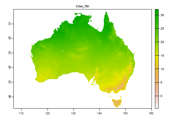
15.8 Gb | Clim_TXI |
Name : Clim_TXI
Description : Maximum temperature - monthly minimum (�C)
Source : CSIRO
Metadata : https://shiny.esoil.io/Apps/Covariates?Attribute=Climate&Name=Clim_TXI&Resolution=30m
Units : degrees celcius
SCORPAN : Climate
Original Resolution : 90m
|
Maximum temperature - monthly minimum (�C) | MetaData |
 Click to enlarge the image
|
|
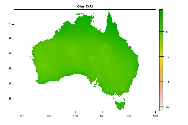
15.9 Gb | Clim_TXRI |
Name : Clim_TXRI
Description : Temperature - min difference in max between successive months
Source : CSIRO
Metadata : https://shiny.esoil.io/Apps/Covariates?Attribute=Climate&Name=Clim_TXRI&Resolution=30m
Units : degrees celcius per day
SCORPAN : Climate
Original Resolution : 90m
|
Temperature - min difference in max between successive months | MetaData |
 Click to enlarge the image
|
|
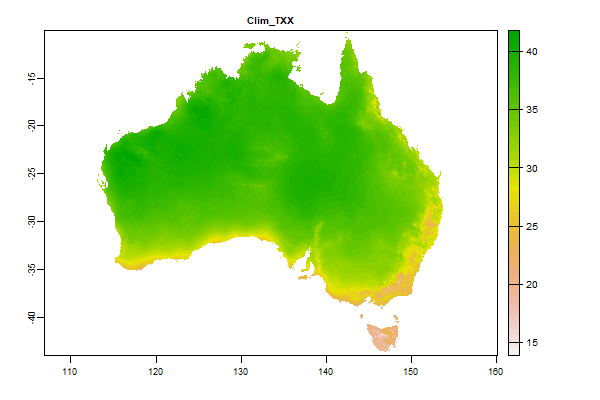
13.5 Gb | Clim_TXX |
Name : Clim_TXX
Description : Maximum temperature - monthly maximum (�C)
Source : CSIRO
Metadata : https://shiny.esoil.io/Apps/Covariates?Attribute=Climate&Name=Clim_TXX&Resolution=30m
Units : degrees celcius
SCORPAN : Climate
Original Resolution : 90m
|
Maximum temperature - monthly maximum (�C) | MetaData |
 Click to enlarge the image
|
|
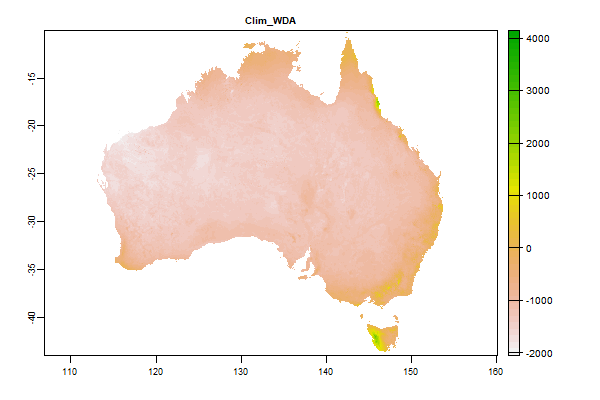
16.2 Gb | Clim_WDA |
Name : Clim_WDA
Description : Annual atmospheric water deficit (annual precipitation � annual potential evaporation) (mm)
Source : CSIRO
Metadata : https://shiny.esoil.io/Apps/Covariates?Attribute=Climate&Name=Clim_WDA&Resolution=30m
Units : mm
SCORPAN : Climate
Original Resolution : 90m
|
Annual atmospheric water deficit (annual precipitation � annual potential evaporation) (mm) | MetaData |
 Click to enlarge the image
|
|
15.2 Gb | Clim_WDI |
Name : Clim_WDI
Description : Minimum monthly atmospheric water deficit (precipitation - potential evaporation) (mm)
Source : CSIRO
Metadata : https://shiny.esoil.io/Apps/Covariates?Attribute=Climate&Name=Clim_WDI&Resolution=30m
Units : mm
SCORPAN : Climate
Original Resolution : 90m
|
Minimum monthly atmospheric water deficit (precipitation - potential evaporation) (mm) | MetaData |
 Click to enlarge the image
|
|
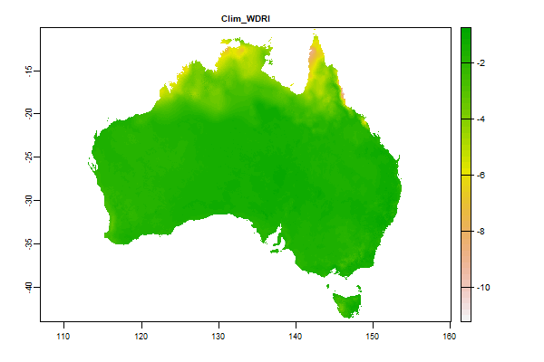
15.6 Gb | Clim_WDRI |
Name : Clim_WDRI
Description : Atmospheric water deficit seasonality � minimum of differences between successive months
Source : CSIRO
Metadata : https://shiny.esoil.io/Apps/Covariates?Attribute=Climate&Name=Clim_WDRI&Resolution=30m
Units : mm
SCORPAN : Climate
Original Resolution : 90m
|
Atmospheric water deficit seasonality � minimum of differences between successive months | MetaData |
 Click to enlarge the image
|
|
587.3 Mb | Clim_WDRX |
Name : Clim_WDRX
Description : Atmospheric water deficit seasonality � maximum of differences between successive months
Source : CSIRO
Metadata : https://shiny.esoil.io/Apps/Covariates?Attribute=Climate&Name=Clim_WDRX&Resolution=30m
Units : mm/day
SCORPAN : Climate
Original Resolution : 90m
|
Atmospheric water deficit seasonality � maximum of differences between successive months | MetaData |
 Click to enlarge the image
|
|
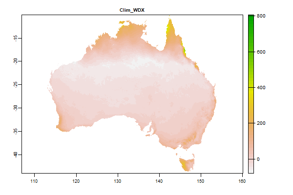
17.3 Gb | Clim_WDX |
Name : Clim_WDX
Description : Maximum monthly atmospheric water deficit (precipitation - potential evaporation) (mm)
Source : CSIRO
Metadata : https://shiny.esoil.io/Apps/Covariates?Attribute=Climate&Name=Clim_WDX&Resolution=30m
Units : mm/day
SCORPAN : Climate
Original Resolution : 90m
|
Maximum monthly atmospheric water deficit (precipitation - potential evaporation) (mm) | MetaData |
 Click to enlarge the image
|
|
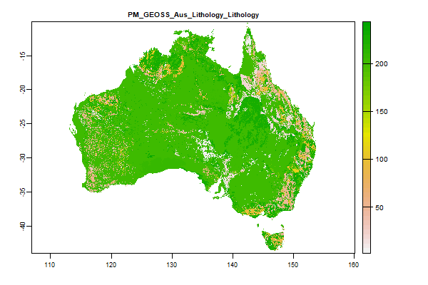
749.8 Mb | PM_GEOSS_Aus_Lithology_Lithology |
Name : PM_GEOSS_Aus_Lithology_Lithology
Description : GEOSS Ecosystem Mapping for Australia - Lithology
Source : TERN
Metadata : https://shiny.esoil.io/Apps/Covariates?Attribute=Parent_Material&Name=PM_GEOSS_Aus_Lithology_Lithology&Resolution=30m
Units : none
SCORPAN : Parent_Material
Original Resolution : 90m
|
GEOSS Ecosystem Mapping for Australia - Lithology | MetaData |
 Click to enlarge the image
|
|
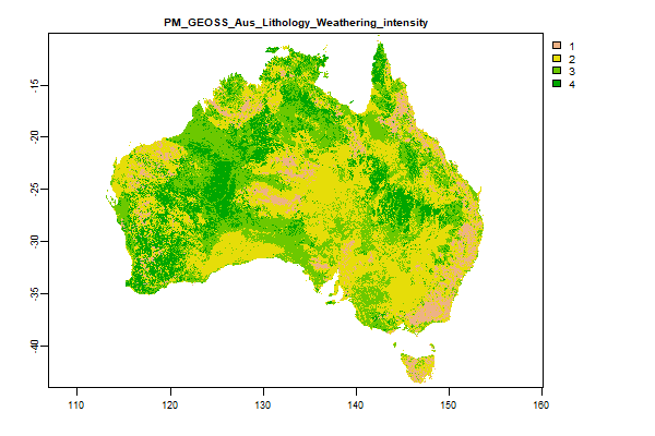
1006.3 Mb | PM_GEOSS_Aus_Lithology_Weathering_intensity |
Name : PM_GEOSS_Aus_Lithology_Weathering_intensity
Description : GEOSS Ecosystem Mapping for Australia - Lithology Weathering Intensity
Source : TERN
Metadata : https://shiny.esoil.io/Apps/Covariates?Attribute=Parent_Material&Name=PM_GEOSS_Aus_Lithology_Weathering_intensity&Resolution=30m
Units : none
SCORPAN : Parent_Material
Original Resolution : 90m
|
GEOSS Ecosystem Mapping for Australia - Lithology Weathering Intensity | MetaData |
 Click to enlarge the image
|
|
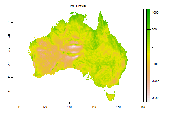
3.6 Gb | PM_Gravity |
Name : PM_Gravity
Description : Fifth Edition Total Magnetic Intensity (TMI) Anomaly Grid of Australia
Source : Geoscience Australia
Metadata : https://shiny.esoil.io/Apps/Covariates?Attribute=Parent_Material&Name=PM_Gravity&Resolution=30m
Units : none
SCORPAN : Parent_Material
Original Resolution : Unkown
|
Fifth Edition Total Magnetic Intensity (TMI) Anomaly Grid of Australia | MetaData |
 Click to enlarge the image
|
|
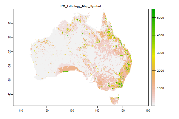
1 Gb | PM_Lithology_Map_Symbol |
Name : PM_Lithology_Map_Symbol
Description : Surface Geology of Australia 1:1 million scale dataset 2012 edition - Geologic Unit
Source : Geoscience Australia
Metadata : https://shiny.esoil.io/Apps/Covariates?Attribute=Parent_Material&Name=PM_Lithology_Map_Symbol&Resolution=30m
Units : none
SCORPAN : Parent_Material
Original Resolution : NA
|
Surface Geology of Australia 1:1 million scale dataset 2012 edition - Geologic Unit | MetaData |
 Click to enlarge the image
|
|
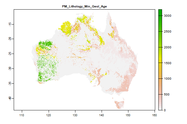
835.3 Mb | PM_Lithology_Min_Geol_Age |
Name : PM_Lithology_Min_Geol_Age
Description : Surface Geology of Australia 1:1 million scale dataset 2012 edition - Minimum Geologic Age
Source : Geoscience Australia
Metadata : https://shiny.esoil.io/Apps/Covariates?Attribute=Parent_Material&Name=PM_Lithology_Min_Geol_Age&Resolution=30m
Units : none
SCORPAN : Parent_Material
Original Resolution : NA
|
Surface Geology of Australia 1:1 million scale dataset 2012 edition - Minimum Geologic Age | MetaData |
 Click to enlarge the image
|
|
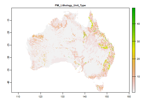
782.6 Mb | PM_Lithology_Unit_Type |
Name : PM_Lithology_Unit_Type
Description : Surface Geology of Australia 1:1 million scale dataset 2012 edition - Lithology Type
Source : Geoscience Australia
Metadata : https://shiny.esoil.io/Apps/Covariates?Attribute=Parent_Material&Name=PM_Lithology_Unit_Type&Resolution=30m
Units : none
SCORPAN : Parent_Material
Original Resolution : NA
|
Surface Geology of Australia 1:1 million scale dataset 2012 edition - Lithology Type | MetaData |
 Click to enlarge the image
|
|
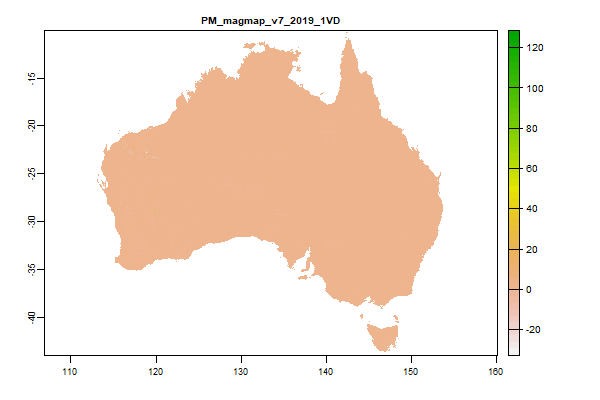
22.6 Gb | PM_magmap_v7_2019_1VD |
Name : PM_magmap_v7_2019_1VD
Description : Total Magnetic Intensity (TMI) grid of Magnetic Map of Australia. 3rd Edition, 1999 survey - 1VD
Source : Geoscience Australia
Metadata : https://shiny.esoil.io/Apps/Covariates?Attribute=Parent_Material&Name=PM_magmap_v7_2019_1VD&Resolution=30m
Units : none
SCORPAN : Parent_Material
Original Resolution : 0.004 Degrees
|
Total Magnetic Intensity (TMI) grid of Magnetic Map of Australia. 3rd Edition, 1999 survey - 1VD | MetaData |
 Click to enlarge the image
|
|
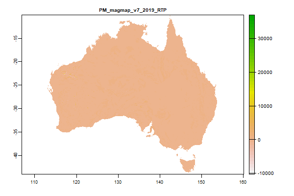
19.1 Gb | PM_magmap_v7_2019_RTP |
Name : PM_magmap_v7_2019_RTP
Description : Total Magnetic Intensity (TMI) grid of Magnetic Map of Australia. 3rd Edition, 1999 survey - RTP
Source : Geoscience Australia
Metadata : https://shiny.esoil.io/Apps/Covariates?Attribute=Parent_Material&Name=PM_magmap_v7_2019_RTP&Resolution=30m
Units : none
SCORPAN : Parent_Material
Original Resolution : 0.004 Degrees
|
Total Magnetic Intensity (TMI) grid of Magnetic Map of Australia. 3rd Edition, 1999 survey - RTP | MetaData |
 Click to enlarge the image
|
|
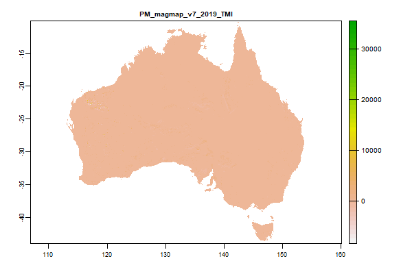
18.6 Gb | PM_magmap_v7_2019_TMI |
Name : PM_magmap_v7_2019_TMI
Description : Total Magnetic Intensity (TMI) grid of Magnetic Map of Australia. 3rd Edition, 1999 survey - TMI
Source : Geoscience Australia
Metadata : https://shiny.esoil.io/Apps/Covariates?Attribute=Parent_Material&Name=PM_magmap_v7_2019_TMI&Resolution=30m
Units : none
SCORPAN : Parent_Material
Original Resolution : 0.004 Degrees
|
Total Magnetic Intensity (TMI) grid of Magnetic Map of Australia. 3rd Edition, 1999 survey - TMI | MetaData |
 Click to enlarge the image
|
|
18.2 Gb | PM_radmap_v4_2019_filtered_dose_GAPFilled |
Name : PM_radmap_v4_2019_filtered_dose_GAPFilled
Description : Radiometric grid of Australia (Radmap) v4 2019 - Filtered dose
Source : Geoscience Australia
Metadata : https://shiny.esoil.io/Apps/Covariates?Attribute=Parent_Material&Name=PM_radmap_v4_2019_filtered_dose_GAPFilled&Resolution=30m
Units : none
SCORPAN : Parent_Material
Original Resolution : 0.001 Degrees
|
Radiometric grid of Australia (Radmap) v4 2019 - Filtered dose | MetaData |
 Click to enlarge the image
|
|
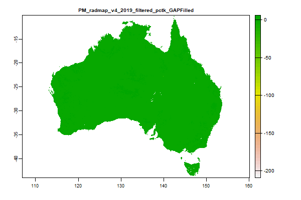
18.8 Gb | PM_radmap_v4_2019_filtered_pctk_GAPFilled |
Name : PM_radmap_v4_2019_filtered_pctk_GAPFilled
Description : Radiometric grid of Australia (Radmap) v4 2019 - Potassium
Source : Geoscience Australia
Metadata : https://shiny.esoil.io/Apps/Covariates?Attribute=Parent_Material&Name=PM_radmap_v4_2019_filtered_pctk_GAPFilled&Resolution=30m
Units : percent
SCORPAN : Parent_Material
Original Resolution : 0.001 Degrees
|
Radiometric grid of Australia (Radmap) v4 2019 - Potassium | MetaData |
 Click to enlarge the image
|
|
18.6 Gb | PM_radmap_v4_2019_filtered_ppmt_GAPFilled |
Name : PM_radmap_v4_2019_filtered_ppmt_GAPFilled
Description : Radiometric grid of Australia (Radmap) v4 2019 - Thorium
Source : Geoscience Australia
Metadata : https://shiny.esoil.io/Apps/Covariates?Attribute=Parent_Material&Name=PM_radmap_v4_2019_filtered_ppmt_GAPFilled&Resolution=30m
Units : ppm
SCORPAN : Parent_Material
Original Resolution : 0.001 Degrees
|
Radiometric grid of Australia (Radmap) v4 2019 - Thorium | MetaData |
 Click to enlarge the image
|
|
18.8 Gb | PM_radmap_v4_2019_filtered_ppmu_GAPFilled |
Name : PM_radmap_v4_2019_filtered_ppmu_GAPFilled
Description : Radiometric grid of Australia (Radmap) v4 2019 - Uranium
Source : Geoscience Australia
Metadata : https://shiny.esoil.io/Apps/Covariates?Attribute=Parent_Material&Name=PM_radmap_v4_2019_filtered_ppmu_GAPFilled&Resolution=30m
Units : ppm
SCORPAN : Parent_Material
Original Resolution : 0.001 Degrees
|
Radiometric grid of Australia (Radmap) v4 2019 - Uranium | MetaData |
 Click to enlarge the image
|
|
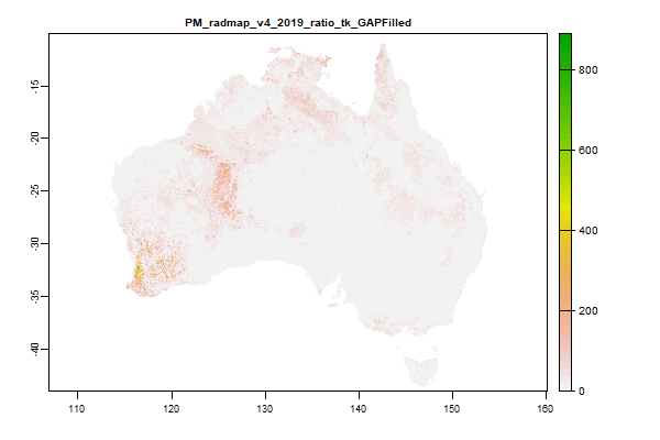
18.8 Gb | PM_radmap_v4_2019_ratio_tk_GAPFilled |
Name : PM_radmap_v4_2019_ratio_tk_GAPFilled
Description : Radiometric grid of Australia (Radmap) v4 2019 - Thorium Potassium ratio
Source : Geoscience Australia
Metadata : https://shiny.esoil.io/Apps/Covariates?Attribute=Parent_Material&Name=PM_radmap_v4_2019_ratio_tk_GAPFilled&Resolution=30m
Units : ratio
SCORPAN : Parent_Material
Original Resolution : 0.001 Degrees
|
Radiometric grid of Australia (Radmap) v4 2019 - Thorium Potassium ratio | MetaData |
 Click to enlarge the image
|
|
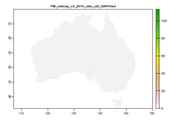
19.5 Gb | PM_radmap_v4_2019_ratio_u2t_GAPFilled |
Name : PM_radmap_v4_2019_ratio_u2t_GAPFilled
Description : Radiometric grid of Australia (Radmap) v4 2019 - Uranium Thorium ratio
Source : Geoscience Australia
Metadata : https://shiny.esoil.io/Apps/Covariates?Attribute=Parent_Material&Name=PM_radmap_v4_2019_ratio_u2t_GAPFilled&Resolution=30m
Units : ratio
SCORPAN : Parent_Material
Original Resolution : 0.001 Degrees
|
Radiometric grid of Australia (Radmap) v4 2019 - Uranium Thorium ratio | MetaData |
 Click to enlarge the image
|
|
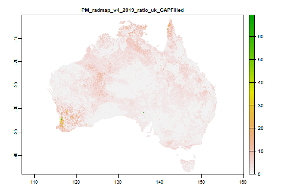
19 Gb | PM_radmap_v4_2019_ratio_uk_GAPFilled |
Name : PM_radmap_v4_2019_ratio_uk_GAPFilled
Description : Radiometric grid of Australia (Radmap) v4 2019 - Uranium Potassium ratio
Source : Geoscience Australia
Metadata : https://shiny.esoil.io/Apps/Covariates?Attribute=Parent_Material&Name=PM_radmap_v4_2019_ratio_uk_GAPFilled&Resolution=30m
Units : ratio
SCORPAN : Parent_Material
Original Resolution : 0.001 Degrees
|
Radiometric grid of Australia (Radmap) v4 2019 - Uranium Potassium ratio | MetaData |
 Click to enlarge the image
|
|
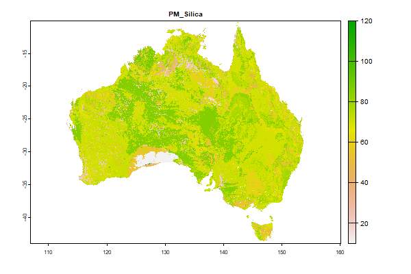
795.8 Mb | PM_Silica |
Name : PM_Silica
Description : Estimated silica content of the geology
Source : CSIRO
Metadata : https://shiny.esoil.io/Apps/Covariates?Attribute=Parent_Material&Name=PM_Silica&Resolution=30m
Units : none
SCORPAN : Parent_Material
Original Resolution : NA
|
Estimated silica content of the geology | MetaData |
 Click to enlarge the image
|
|
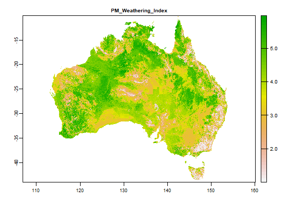
18.9 Gb | PM_Weathering_Index |
Name : PM_Weathering_Index
Description : Weathering Index
Source : Geoscience Australia
Metadata : https://shiny.esoil.io/Apps/Covariates?Attribute=Parent_Material&Name=PM_Weathering_Index&Resolution=30m
Units : none
SCORPAN : Parent_Material
Original Resolution : 90m
|
Weathering Index | MetaData |
 Click to enlarge the image
|
|
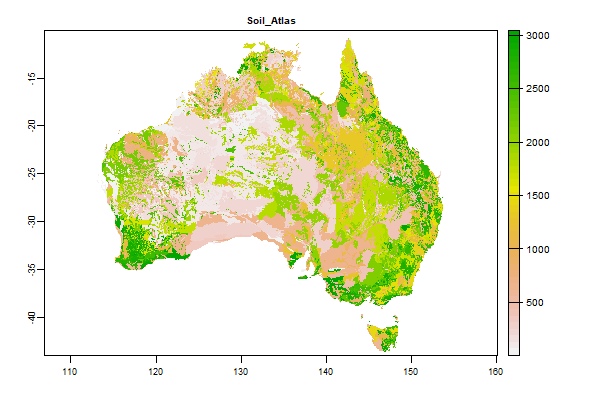
768.8 Mb | Soil_Atlas |
Name : Soil_Atlas
Description : Atlas of Australian Soils (1:2 million)
Source : CSIRO
Metadata : https://shiny.esoil.io/Apps/Covariates?Attribute=Soil&Name=Soil_Atlas&Resolution=30m
Units : none
SCORPAN : Soil
Original Resolution : none
|
Atlas of Australian Soils (1:2 million) | MetaData |
 Click to enlarge the image
|
|
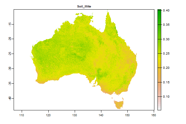
20.1 Gb | Soil_Illite |
Name : Soil_Illite
Description : Maps clay minerals � illite in Australian soils - 0 - 20cm
Source : CSIRO
Metadata : https://shiny.esoil.io/Apps/Covariates?Attribute=Soil&Name=Soil_Illite&Resolution=30m
Units : percent
SCORPAN : Soil
Original Resolution : 0.0008333 Degrees
|
Maps clay minerals � illite in Australian soils - 0 - 20cm | MetaData |
 Click to enlarge the image
|
|
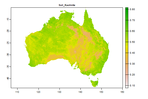
19.1 Gb | Soil_Kaolinite |
Name : Soil_Kaolinite
Description : Maps clay minerals � kaolinite in Australian soils - 0 - 20cm
Source : CSIRO
Metadata : https://shiny.esoil.io/Apps/Covariates?Attribute=Soil&Name=Soil_Kaolinite&Resolution=30m
Units : percent
SCORPAN : Soil
Original Resolution : 0.0008333 Degrees
|
Maps clay minerals � kaolinite in Australian soils - 0 - 20cm | MetaData |
 Click to enlarge the image
|
|
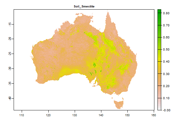
19.9 Gb | Soil_Smectite |
Name : Soil_Smectite
Description : Maps clay minerals � smectite in Australian soils - 0 - 20cm
Source : CSIRO
Metadata : https://shiny.esoil.io/Apps/Covariates?Attribute=Soil&Name=Soil_Smectite&Resolution=30m
Units : percent
SCORPAN : Soil
Original Resolution : 0.0008333 Degrees
|
Maps clay minerals � smectite in Australian soils - 0 - 20cm | MetaData |
 Click to enlarge the image
|
|
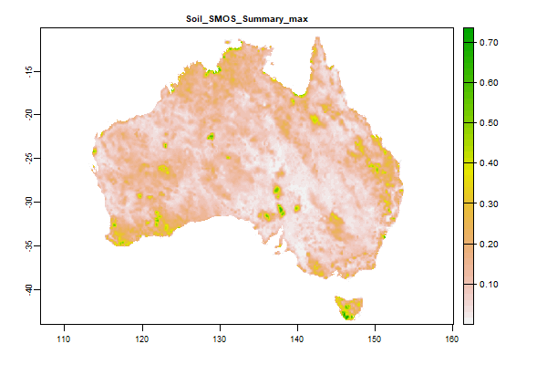
3 Gb | Soil_SMOS_Summary_max |
Name : Soil_SMOS_Summary_max
Description : SMOS Level 2 Soil Moisture - Maximum of the timeseries - 2015 to 2020
Source : European Space Agency
Metadata : https://shiny.esoil.io/Apps/Covariates?Attribute=Soil&Name=Soil_SMOS_Summary_max&Resolution=30m
Units : none
SCORPAN : Soil
Original Resolution : 0.01 Degrees
|
SMOS Level 2 Soil Moisture - Maximum of the timeseries - 2015 to 2020 | MetaData |
 Click to enlarge the image
|
|
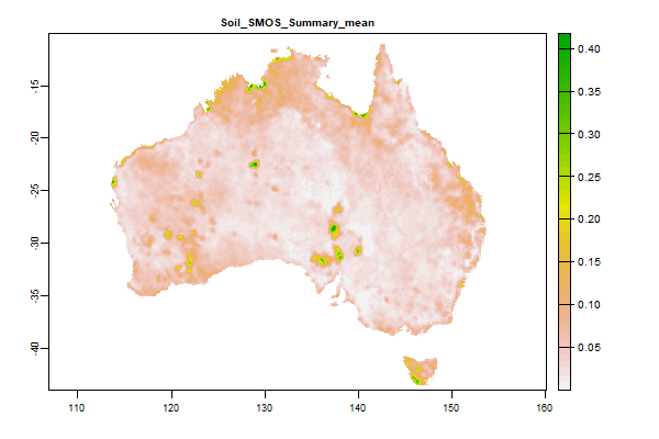
3 Gb | Soil_SMOS_Summary_mean |
Name : Soil_SMOS_Summary_mean
Description : SMOS Level 2 Soil Moisture - Mean of the timeseries - 2015 to 2020
Source : European Space Agency
Metadata : https://shiny.esoil.io/Apps/Covariates?Attribute=Soil&Name=Soil_SMOS_Summary_mean&Resolution=30m
Units : none
SCORPAN : Soil
Original Resolution : 0.01 Degrees
|
SMOS Level 2 Soil Moisture - Mean of the timeseries - 2015 to 2020 | MetaData |
 Click to enlarge the image
|
|
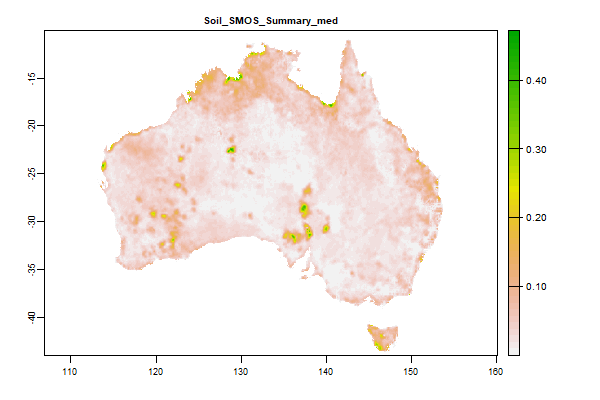
3.1 Gb | Soil_SMOS_Summary_med |
Name : Soil_SMOS_Summary_med
Description : SMOS Level 2 Soil Moisture - Median of the timeseries - 2015 to 2020
Source : European Space Agency
Metadata : https://shiny.esoil.io/Apps/Covariates?Attribute=Soil&Name=Soil_SMOS_Summary_med&Resolution=30m
Units : none
SCORPAN : Soil
Original Resolution : 0.01 Degrees
|
SMOS Level 2 Soil Moisture - Median of the timeseries - 2015 to 2020 | MetaData |
 Click to enlarge the image
|
|
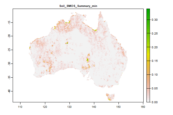
3.3 Gb | Soil_SMOS_Summary_min |
Name : Soil_SMOS_Summary_min
Description : SMOS Level 2 Soil Moisture - Minimum of the timeseries - 2015 to 2020
Source : European Space Agency
Metadata : https://shiny.esoil.io/Apps/Covariates?Attribute=Soil&Name=Soil_SMOS_Summary_min&Resolution=30m
Units : none
SCORPAN : Soil
Original Resolution : 0.01 Degrees
|
SMOS Level 2 Soil Moisture - Minimum of the timeseries - 2015 to 2020 | MetaData |
 Click to enlarge the image
|
|
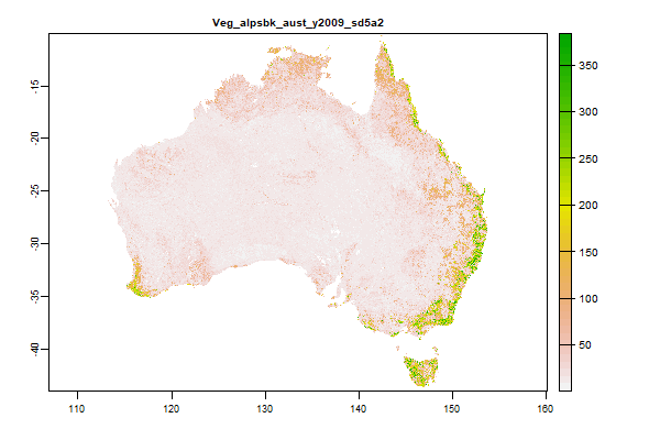
21.6 Gb | Veg_alpsbk_aust_y2009_sd5a2 |
Name : Veg_alpsbk_aust_y2009_sd5a2
Description : Height of peak foliage density
Source : QLD Department of Environment & Science
Metadata : https://shiny.esoil.io/Apps/Covariates?Attribute=Organisms&Name=Veg_alpsbk_aust_y2009_sd5a2&Resolution=30m
Units : none
SCORPAN : Organisms
Original Resolution : 30m
|
Height of peak foliage density | MetaData |
 Click to enlarge the image
|
|
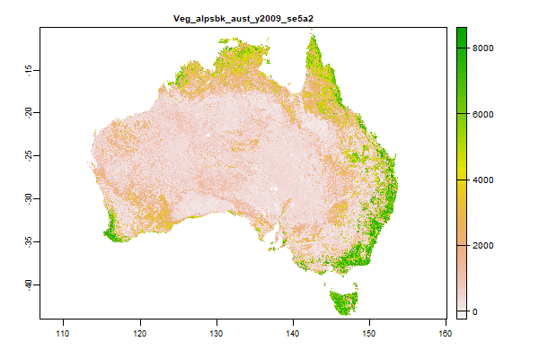
24 Gb | Veg_alpsbk_aust_y2009_se5a2 |
Name : Veg_alpsbk_aust_y2009_se5a2
Description : Total plant cover fraction
Source : QLD Department of Environment & Science
Metadata : https://shiny.esoil.io/Apps/Covariates?Attribute=Organisms&Name=Veg_alpsbk_aust_y2009_se5a2&Resolution=30m
Units : none
SCORPAN : Organisms
Original Resolution : 30m
|
Total plant cover fraction | MetaData |
 Click to enlarge the image
|
|
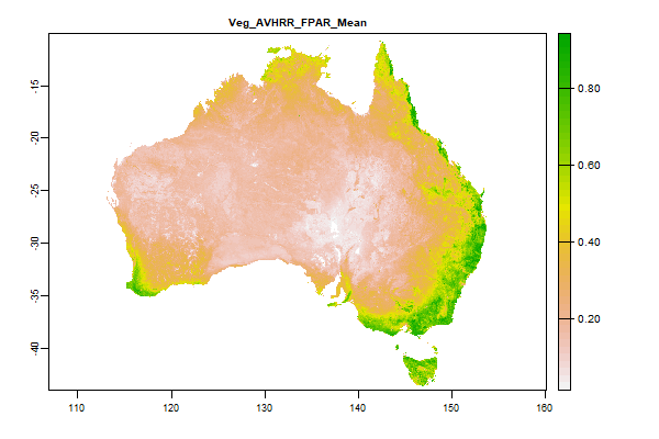
3.2 Gb | Veg_AVHRR_FPAR_Mean |
Name : Veg_AVHRR_FPAR_Mean
Description : Fraction of Photosynthetically Active Radiation (FPAR) - AVHRR CSIRO Land and Water algorithm Australia coverage - Mean Value in Timeseries
Source : Time Series Remote Sensing Team, CSIRO Land and Water
Metadata : https://shiny.esoil.io/Apps/Covariates?Attribute=Organisms&Name=Veg_AVHRR_FPAR_Mean&Resolution=30m
Units : percent
SCORPAN : Organisms
Original Resolution : 0.01 Degrees
|
Fraction of Photosynthetically Active Radiation (FPAR) - AVHRR CSIRO Land and Water algorithm Australia coverage - Mean Value in Timeseries | MetaData |
 Click to enlarge the image
|
|
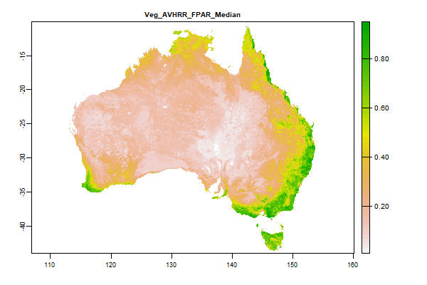
1.7 Gb | Veg_AVHRR_FPAR_Median |
Name : Veg_AVHRR_FPAR_Median
Description : Fraction of Photosynthetically Active Radiation (FPAR) - AVHRR CSIRO Land and Water algorithm Australia coverage - Median Value in Timeseries
Source : Time Series Remote Sensing Team, CSIRO Land and Water
Metadata : https://shiny.esoil.io/Apps/Covariates?Attribute=Organisms&Name=Veg_AVHRR_FPAR_Median&Resolution=30m
Units : percent
SCORPAN : Organisms
Original Resolution : 0.01 Degrees
|
Fraction of Photosynthetically Active Radiation (FPAR) - AVHRR CSIRO Land and Water algorithm Australia coverage - Median Value in Timeseries | MetaData |
 Click to enlarge the image
|
|
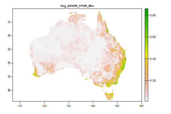
1.7 Gb | Veg_AVHRR_FPAR_Min |
Name : Veg_AVHRR_FPAR_Min
Description : Fraction of Photosynthetically Active Radiation (FPAR) - AVHRR CSIRO Land and Water algorithm Australia coverage - Minimum Value in Timeseries
Source : Time Series Remote Sensing Team, CSIRO Land and Water
Metadata : https://shiny.esoil.io/Apps/Covariates?Attribute=Organisms&Name=Veg_AVHRR_FPAR_Min&Resolution=30m
Units : percent
SCORPAN : Organisms
Original Resolution : 0.01 Degrees
|
Fraction of Photosynthetically Active Radiation (FPAR) - AVHRR CSIRO Land and Water algorithm Australia coverage - Minimum Value in Timeseries | MetaData |
 Click to enlarge the image
|
|
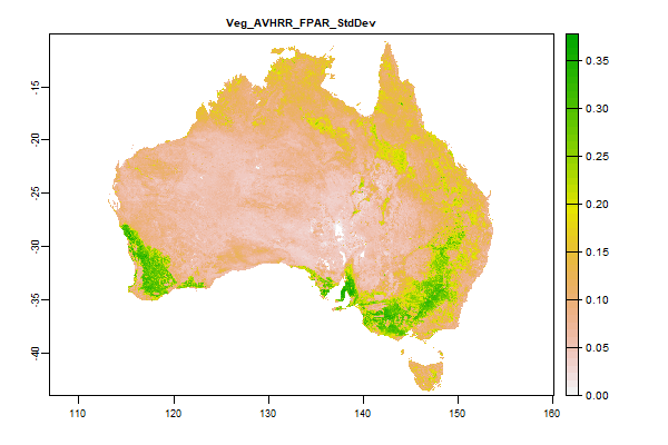
3.3 Gb | Veg_AVHRR_FPAR_StdDev |
Name : Veg_AVHRR_FPAR_StdDev
Description : Fraction of Photosynthetically Active Radiation (FPAR) - AVHRR CSIRO Land and Water algorithm Australia coverage - Standard Deviation of Value in Timeseries
Source : Time Series Remote Sensing Team, CSIRO Land and Water
Metadata : https://shiny.esoil.io/Apps/Covariates?Attribute=Organisms&Name=Veg_AVHRR_FPAR_StdDev&Resolution=30m
Units : percent
SCORPAN : Organisms
Original Resolution : 0.01 Degrees
|
Fraction of Photosynthetically Active Radiation (FPAR) - AVHRR CSIRO Land and Water algorithm Australia coverage - Standard Deviation of Value in Timeseries | MetaData |
 Click to enlarge the image
|
|
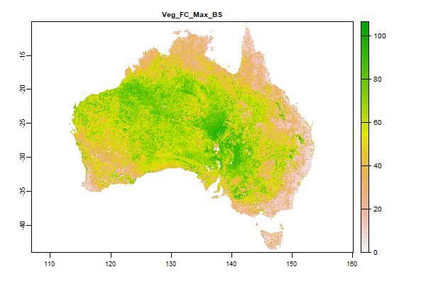
9.1 Gb | Veg_FC_Max_BS |
Name : Veg_FC_Max_BS
Description : Landsat Fractional cover - Bare Soil -Maximum of the timeseries - 1987 - 2019
Source : QLD Department of Environment & Science
Metadata : https://shiny.esoil.io/Apps/Covariates?Attribute=Organisms&Name=Veg_FC_Max_BS&Resolution=30m
Units : percent
SCORPAN : Organisms
Original Resolution : 30m
|
Landsat Fractional cover - Bare Soil -Maximum of the timeseries - 1987 - 2019 | MetaData |
 Click to enlarge the image
|
|
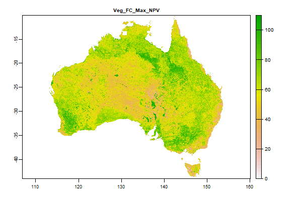
8.4 Gb | Veg_FC_Max_NPV |
Name : Veg_FC_Max_NPV
Description : Landsat Fractional cover - Non Photosynthetic Vegetation - Maximum of the timeseries - 1987 - 2019
Source : QLD Department of Environment & Science
Metadata : https://shiny.esoil.io/Apps/Covariates?Attribute=Organisms&Name=Veg_FC_Max_NPV&Resolution=30m
Units : percent
SCORPAN : Organisms
Original Resolution : 30m
|
Landsat Fractional cover - Non Photosynthetic Vegetation - Maximum of the timeseries - 1987 - 2019 | MetaData |
 Click to enlarge the image
|
|
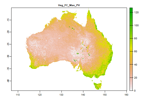
8.5 Gb | Veg_FC_Max_PV |
Name : Veg_FC_Max_PV
Description : Landsat Fractional cover - Photosynthetic Vegetation - Maximum of the timeseries - 1987 - 2019
Source : QLD Department of Environment & Science
Metadata : https://shiny.esoil.io/Apps/Covariates?Attribute=Organisms&Name=Veg_FC_Max_PV&Resolution=30m
Units : percent
SCORPAN : Organisms
Original Resolution : 30m
|
Landsat Fractional cover - Photosynthetic Vegetation - Maximum of the timeseries - 1987 - 2019 | MetaData |
 Click to enlarge the image
|
|
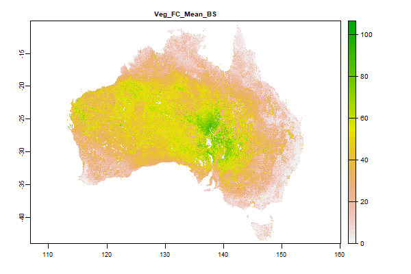
7.7 Gb | Veg_FC_Mean_BS |
Name : Veg_FC_Mean_BS
Description : Landsat Fractional cover - Bare Soil - Mean of the timeseries - 1987 - 2019
Source : QLD Department of Environment & Science
Metadata : https://shiny.esoil.io/Apps/Covariates?Attribute=Organisms&Name=Veg_FC_Mean_BS&Resolution=30m
Units : percent
SCORPAN : Organisms
Original Resolution : 30m
|
Landsat Fractional cover - Bare Soil - Mean of the timeseries - 1987 - 2019 | MetaData |
 Click to enlarge the image
|
|
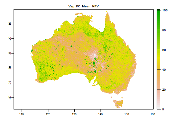
7 Gb | Veg_FC_Mean_NPV |
Name : Veg_FC_Mean_NPV
Description : Landsat Fractional cover - Non Photosynthetic Vegetation - Mean of the timeseries - 1987 - 2019
Source : QLD Department of Environment & Science
Metadata : https://shiny.esoil.io/Apps/Covariates?Attribute=Organisms&Name=Veg_FC_Mean_NPV&Resolution=30m
Units : percent
SCORPAN : Organisms
Original Resolution : 30m
|
Landsat Fractional cover - Non Photosynthetic Vegetation - Mean of the timeseries - 1987 - 2019 | MetaData |
 Click to enlarge the image
|
|
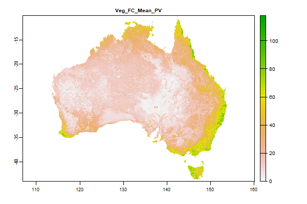
6.9 Gb | Veg_FC_Mean_PV |
Name : Veg_FC_Mean_PV
Description : Landsat Fractional cover - Photosynthetic Vegetation - Mean of the timeseries - 1987 - 2019
Source : QLD Department of Environment & Science
Metadata : https://shiny.esoil.io/Apps/Covariates?Attribute=Organisms&Name=Veg_FC_Mean_PV&Resolution=30m
Units : percent
SCORPAN : Organisms
Original Resolution : 30m
|
Landsat Fractional cover - Photosynthetic Vegetation - Mean of the timeseries - 1987 - 2019 | MetaData |
 Click to enlarge the image
|
|
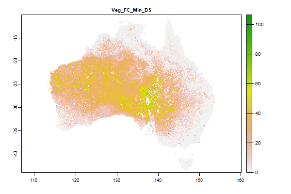
8.5 Gb | Veg_FC_Min_BS |
Name : Veg_FC_Min_BS
Description : Landsat Fractional cover - Bare Soil Minimum of the timeseries - 1987 - 2019
Source : QLD Department of Environment & Science
Metadata : https://shiny.esoil.io/Apps/Covariates?Attribute=Organisms&Name=Veg_FC_Min_BS&Resolution=30m
Units : percent
SCORPAN : Organisms
Original Resolution : 30m
|
Landsat Fractional cover - Bare Soil Minimum of the timeseries - 1987 - 2019 | MetaData |
 Click to enlarge the image
|
|
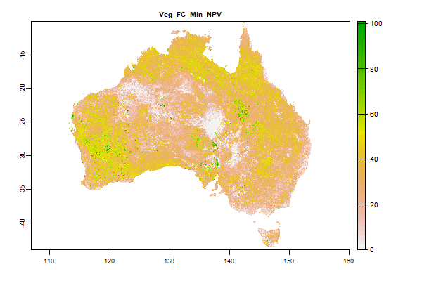
9.2 Gb | Veg_FC_Min_NPV |
Name : Veg_FC_Min_NPV
Description : Landsat Fractional cover - Non Photosynthetic Vegetation - Minimum of the timeseries - 1987 - 2019
Source : QLD Department of Environment & Science
Metadata : https://shiny.esoil.io/Apps/Covariates?Attribute=Organisms&Name=Veg_FC_Min_NPV&Resolution=30m
Units : percent
SCORPAN : Organisms
Original Resolution : 30m
|
Landsat Fractional cover - Non Photosynthetic Vegetation - Minimum of the timeseries - 1987 - 2019 | MetaData |
 Click to enlarge the image
|
|
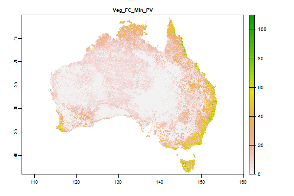
7.3 Gb | Veg_FC_Min_PV |
Name : Veg_FC_Min_PV
Description : Landsat Fractional cove - Photosynthetic Vegetation - Minimum of the timeseries - 1987 - 2019
Source : QLD Department of Environment & Science
Metadata : https://shiny.esoil.io/Apps/Covariates?Attribute=Organisms&Name=Veg_FC_Min_PV&Resolution=30m
Units : percent
SCORPAN : Organisms
Original Resolution : 30m
|
Landsat Fractional cove - Photosynthetic Vegetation - Minimum of the timeseries - 1987 - 2019 | MetaData |
 Click to enlarge the image
|
|
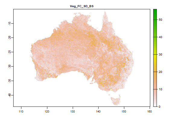
5.8 Gb | Veg_FC_SD_BS |
Name : Veg_FC_SD_BS
Description : Landsat Fractional cover - Bare Soil - Standard deviation of the timeseries - 1987 - 2019
Source : QLD Department of Environment & Science
Metadata : https://shiny.esoil.io/Apps/Covariates?Attribute=Organisms&Name=Veg_FC_SD_BS&Resolution=30m
Units : percent
SCORPAN : Organisms
Original Resolution : 30m
|
Landsat Fractional cover - Bare Soil - Standard deviation of the timeseries - 1987 - 2019 | MetaData |
 Click to enlarge the image
|
|
5.7 Gb | Veg_FC_SD_NPV |
Name : Veg_FC_SD_NPV
Description : Landsat Fractional cover - Non Photosynthetic Vegetation - Standard deviation of the timeseries - 1987 - 2019
Source : QLD Department of Environment & Science
Metadata : https://shiny.esoil.io/Apps/Covariates?Attribute=Organisms&Name=Veg_FC_SD_NPV&Resolution=30m
Units : percent
SCORPAN : Organisms
Original Resolution : 30m
|
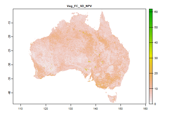
Landsat Fractional cover - Non Photosynthetic Vegetation - Standard deviation of the timeseries - 1987 - 2019 | MetaData |
 Click to enlarge the image
|
|
4.8 Gb | Veg_FC_SD_PV |
Name : Veg_FC_SD_PV
Description : Landsat Fractional cover - Bare Soil - Standard deviation of the timeseries -1987 - 2019
Source : QLD Department of Environment & Science
Metadata : https://shiny.esoil.io/Apps/Covariates?Attribute=Organisms&Name=Veg_FC_SD_PV&Resolution=30m
Units : percent
SCORPAN : Organisms
Original Resolution : 30m
|
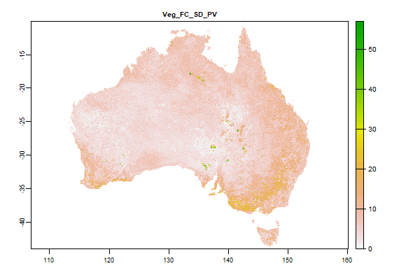
Landsat Fractional cover - Bare Soil - Standard deviation of the timeseries -1987 - 2019 | MetaData |
 Click to enlarge the image
|
|
1003 Mb | Veg_GEOSS_Aus_Vegetation_structural_formations |
Name : Veg_GEOSS_Aus_Vegetation_structural_formations
Description : GEOSS Ecosystem Mapping for Australia - Vegetation Structural Formations
Source : TERN
Metadata : https://shiny.esoil.io/Apps/Covariates?Attribute=Organisms&Name=Veg_GEOSS_Aus_Vegetation_structural_formations&Resolution=30m
Units : none
SCORPAN : Organisms
Original Resolution : 90m
|
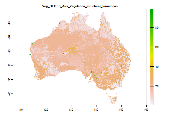
GEOSS Ecosystem Mapping for Australia - Vegetation Structural Formations | MetaData |
 Click to enlarge the image
|
|
553 Mb | Veg_IBRA_regions |
Name : Veg_IBRA_regions
Description : Interim Biogeographic Regionalisation for Australia (IBRA) Version 6_1
Source : Australian Government Department of the Environment, Water, Heritage and the Arts
Metadata : https://shiny.esoil.io/Apps/Covariates?Attribute=Organisms&Name=Veg_IBRA_regions&Resolution=30m
Units : NA
SCORPAN : Organisms
Original Resolution : NA
|
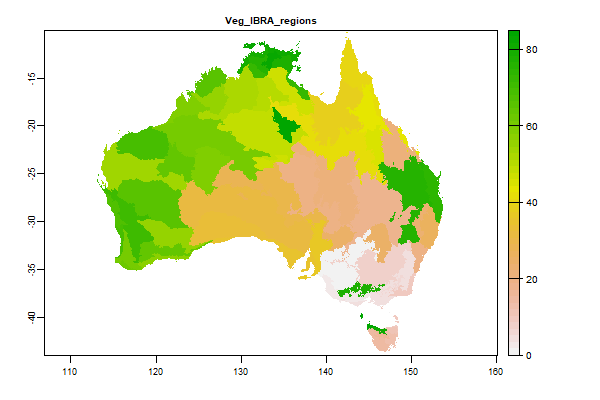
Interim Biogeographic Regionalisation for Australia (IBRA) Version 6_1 | MetaData |
 Click to enlarge the image
|
|
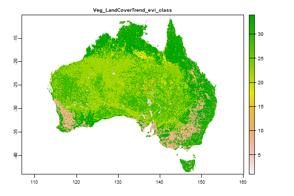
1.5 Gb | Veg_LandCoverTrend_evi_class |
Name : Veg_LandCoverTrend_evi_class
Description : National Dynamic Land Cover Dataset Class
Source : Geoscience Australia
Metadata : https://shiny.esoil.io/Apps/Covariates?Attribute=Organisms&Name=Veg_LandCoverTrend_evi_class&Resolution=30m
Units : None
SCORPAN : Organisms
Original Resolution : 0.00234899 Degrees
|
National Dynamic Land Cover Dataset Class | MetaData |
 Click to enlarge the image
|
|
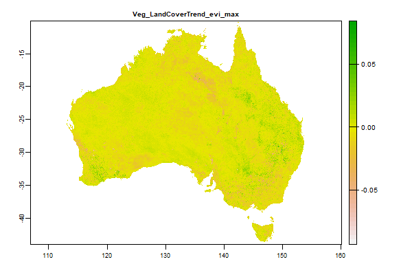
11.8 Gb | Veg_LandCoverTrend_evi_max |
Name : Veg_LandCoverTrend_evi_max
Description : National Dynamic Land Cover Dataset Maximum of the timeseries 2000 - 2008
Source : Geoscience Australia
Metadata : https://shiny.esoil.io/Apps/Covariates?Attribute=Organisms&Name=Veg_LandCoverTrend_evi_max&Resolution=30m
Units : None
SCORPAN : Organisms
Original Resolution : 0.00234899 Degrees
|
National Dynamic Land Cover Dataset Maximum of the timeseries 2000 - 2008 | MetaData |
 Click to enlarge the image
|
|
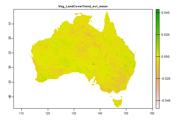
11.6 Gb | Veg_LandCoverTrend_evi_mean |
Name : Veg_LandCoverTrend_evi_mean
Description : National Dynamic Land Cover Dataset Mean of the timeseries 2000 - 2008
Source : Geoscience Australia
Metadata : https://shiny.esoil.io/Apps/Covariates?Attribute=Organisms&Name=Veg_LandCoverTrend_evi_mean&Resolution=30m
Units : None
SCORPAN : Organisms
Original Resolution : 0.00234899 Degrees
|
National Dynamic Land Cover Dataset Mean of the timeseries 2000 - 2008 | MetaData |
 Click to enlarge the image
|
|
11.9 Gb | Veg_LandCoverTrend_evi_min |
Name : Veg_LandCoverTrend_evi_min
Description : National Dynamic Land Cover Dataset Minimum of the timeseries 2000 - 2008
Source : Geoscience Australia
Metadata : https://shiny.esoil.io/Apps/Covariates?Attribute=Organisms&Name=Veg_LandCoverTrend_evi_min&Resolution=30m
Units : None
SCORPAN : Organisms
Original Resolution : 0.00234899 Degrees
|
National Dynamic Land Cover Dataset Minimum of the timeseries 2000 - 2008 | MetaData |
 Click to enlarge the image
|
|
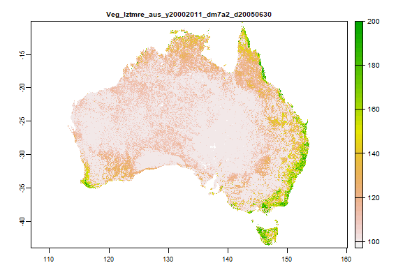
24.6 Gb | Veg_lztmre_aus_y20002011_dm7a2_d20050630 |
Name : Veg_lztmre_aus_y20002011_dm7a2_d20050630
Description : Australian woody vegetation cover - Forest cover
Source : QLD Department of Environment & Science
Metadata : https://shiny.esoil.io/Apps/Covariates?Attribute=Organisms&Name=Veg_lztmre_aus_y20002011_dm7a2_d20050630&Resolution=30m
Units : percent
SCORPAN : Organisms
Original Resolution : 30m
|
Australian woody vegetation cover - Forest cover | MetaData |
 Click to enlarge the image
|
|
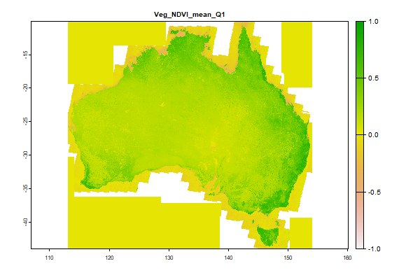
45.3 Gb | Veg_NDVI_mean_Q1 |
Name : Veg_NDVI_mean_Q1
Description : Long-term average Normalized Difference Vegetation Index (NDVI) values derived from could-free Landsat 8 TOA collection - https://developers.google.com/earth-engine/datasets/catalog/landsat-8 - and processed in Google Earth Engine.
Source : University of Sydney
Metadata : https://shiny.esoil.io/Apps/Covariates?Attribute=Organisms&Name=Veg_NDVI_mean_Q1&Resolution=30m
Units : index
SCORPAN : Organisms
Original Resolution : 30m
|
Long-term average Normalized Difference Vegetation Index (NDVI) values derived from could-free Landsat 8 TOA collection - https://developers.google.com/earth-engine/datasets/catalog/landsat-8 - and processed in Google Earth Engine. | MetaData |
 Click to enlarge the image
|
|
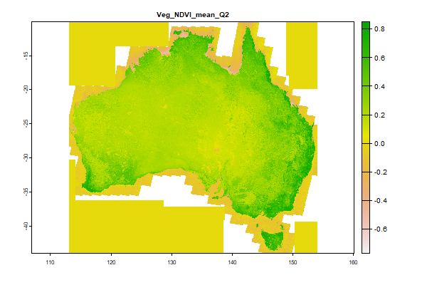
45.3 Gb | Veg_NDVI_mean_Q2 |
Name : Veg_NDVI_mean_Q2
Description : Long-term average Normalized Difference Vegetation Index (NDVI) values derived from could-free Landsat 8 TOA collection - https://developers.google.com/earth-engine/datasets/catalog/landsat-8 - and processed in Google Earth Engine.
Source : University of Sydney
Metadata : https://shiny.esoil.io/Apps/Covariates?Attribute=Organisms&Name=Veg_NDVI_mean_Q2&Resolution=30m
Units : index
SCORPAN : Organisms
Original Resolution : 30m
|
Long-term average Normalized Difference Vegetation Index (NDVI) values derived from could-free Landsat 8 TOA collection - https://developers.google.com/earth-engine/datasets/catalog/landsat-8 - and processed in Google Earth Engine. | MetaData |
 Click to enlarge the image
|
|
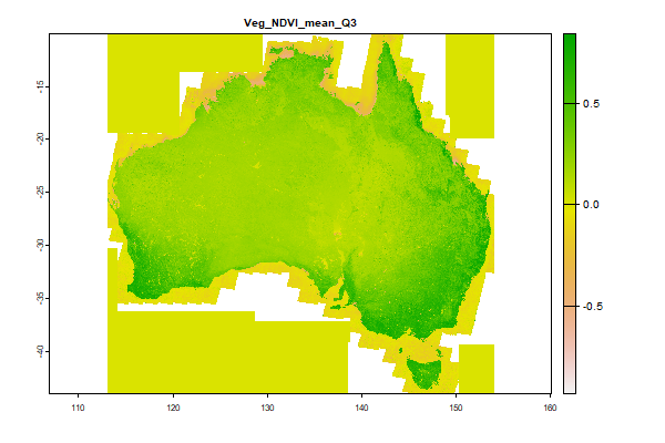
45.2 Gb | Veg_NDVI_mean_Q3 |
Name : Veg_NDVI_mean_Q3
Description : Long-term average Normalized Difference Vegetation Index (NDVI) values derived from could-free Landsat 8 TOA collection - https://developers.google.com/earth-engine/datasets/catalog/landsat-8 - and processed in Google Earth Engine.
Source : University of Sydney
Metadata : https://shiny.esoil.io/Apps/Covariates?Attribute=Organisms&Name=Veg_NDVI_mean_Q3&Resolution=30m
Units : index
SCORPAN : Organisms
Original Resolution : 30m
|
Long-term average Normalized Difference Vegetation Index (NDVI) values derived from could-free Landsat 8 TOA collection - https://developers.google.com/earth-engine/datasets/catalog/landsat-8 - and processed in Google Earth Engine. | MetaData |
 Click to enlarge the image
|
|
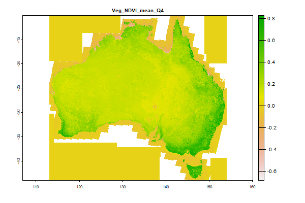
45.1 Gb | Veg_NDVI_mean_Q4 |
Name : Veg_NDVI_mean_Q4
Description : Long-term average Normalized Difference Vegetation Index (NDVI) values derived from could-free Landsat 8 TOA collection - https://developers.google.com/earth-engine/datasets/catalog/landsat-8 - and processed in Google Earth Engine.
Source : University of Sydney
Metadata : https://shiny.esoil.io/Apps/Covariates?Attribute=Organisms&Name=Veg_NDVI_mean_Q4&Resolution=30m
Units : index
SCORPAN : Organisms
Original Resolution : 30m
|
Long-term average Normalized Difference Vegetation Index (NDVI) values derived from could-free Landsat 8 TOA collection - https://developers.google.com/earth-engine/datasets/catalog/landsat-8 - and processed in Google Earth Engine. | MetaData |
 Click to enlarge the image
|
|
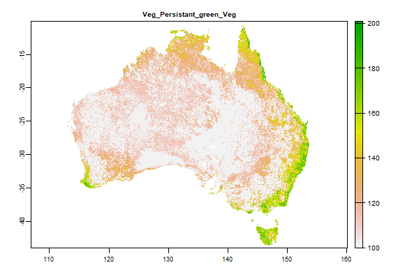
3.6 Gb | Veg_Persistant_green_Veg |
Name : Veg_Persistant_green_Veg
Description : Landsat 2000-2010 Persistent Green-Vegetation Fraction
Source : JRSRP
Metadata : https://shiny.esoil.io/Apps/Covariates?Attribute=Organisms&Name=Veg_Persistant_green_Veg&Resolution=30m
Units :
SCORPAN : Organisms
Original Resolution :
|
Landsat 2000-2010 Persistent Green-Vegetation Fraction | MetaData |
 Click to enlarge the image
|
|
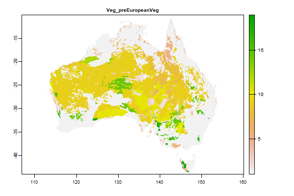
555.6 Mb | Veg_preEuropeanVeg |
Name : Veg_preEuropeanVeg
Description : Pre-European Veg
Source : Australian Government Department of Agriculture, Water and the Environment
Metadata : https://shiny.esoil.io/Apps/Covariates?Attribute=Organisms&Name=Veg_preEuropeanVeg&Resolution=30m
Units :
SCORPAN : Organisms
Original Resolution : 100m
|
Pre-European Veg | MetaData |
 Click to enlarge the image
|
|
5.3 Gb | Other_A_MOD_DAY_4dim_3ord_Spatial_Temporal_max |
Name : Other_A_MOD_DAY_4dim_3ord_Spatial_Temporal_max
Description : Actual Evaporation Modelling - Available energy - Maximum of the temporal monthly timeseries
Source : CSIRO
Metadata : https://shiny.esoil.io/Apps/Covariates?Attribute=Other&Name=Other_A_MOD_DAY_4dim_3ord_Spatial_Temporal_max&Resolution=30m
Units : mm per day
SCORPAN : Other
Original Resolution : 0.005 Degrees
|
Actual Evaporation Modelling - Available energy - Maximum of the temporal monthly timeseries | MetaData |
 Click to enlarge the image
|
|
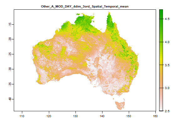
5.3 Gb | Other_A_MOD_DAY_4dim_3ord_Spatial_Temporal_mean |
Name : Other_A_MOD_DAY_4dim_3ord_Spatial_Temporal_mean
Description : Actual Evaporation Modelling - Available energy - Mean of the temporal monthly timeseries
Source : CSIRO
Metadata : https://shiny.esoil.io/Apps/Covariates?Attribute=Other&Name=Other_A_MOD_DAY_4dim_3ord_Spatial_Temporal_mean&Resolution=30m
Units : mm per day
SCORPAN : Other
Original Resolution : 0.005 Degrees
|
Actual Evaporation Modelling - Available energy - Mean of the temporal monthly timeseries | MetaData |
 Click to enlarge the image
|
|
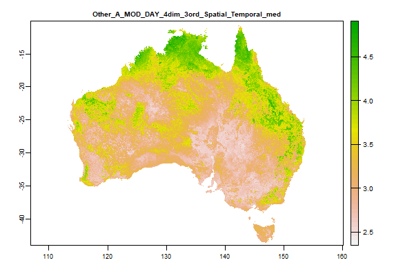
5.4 Gb | Other_A_MOD_DAY_4dim_3ord_Spatial_Temporal_med |
Name : Other_A_MOD_DAY_4dim_3ord_Spatial_Temporal_med
Description : Actual Evaporation Modelling - Available energy - Median of the temporal monthly timeseries
Source : CSIRO
Metadata : https://shiny.esoil.io/Apps/Covariates?Attribute=Other&Name=Other_A_MOD_DAY_4dim_3ord_Spatial_Temporal_med&Resolution=30m
Units : mm per day
SCORPAN : Other
Original Resolution : 0.005 Degrees
|
Actual Evaporation Modelling - Available energy - Median of the temporal monthly timeseries | MetaData |
 Click to enlarge the image
|
|
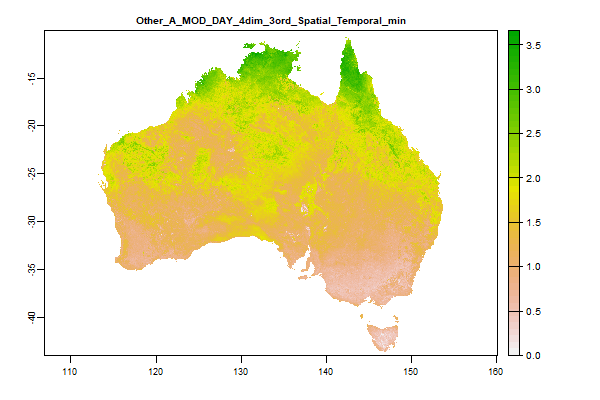
5.6 Gb | Other_A_MOD_DAY_4dim_3ord_Spatial_Temporal_min |
Name : Other_A_MOD_DAY_4dim_3ord_Spatial_Temporal_min
Description : Actual Evaporation Modelling - Available energy - Minimum of the temporal monthly timeseries
Source : CSIRO
Metadata : https://shiny.esoil.io/Apps/Covariates?Attribute=Other&Name=Other_A_MOD_DAY_4dim_3ord_Spatial_Temporal_min&Resolution=30m
Units : mm per day
SCORPAN : Other
Original Resolution : 0.005 Degrees
|
Actual Evaporation Modelling - Available energy - Minimum of the temporal monthly timeseries | MetaData |
 Click to enlarge the image
|
|
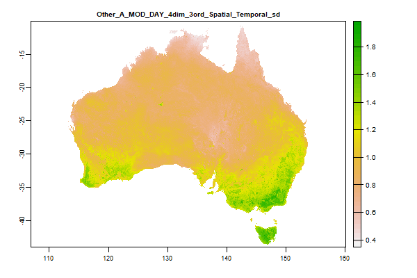
5.3 Gb | Other_A_MOD_DAY_4dim_3ord_Spatial_Temporal_sd |
Name : Other_A_MOD_DAY_4dim_3ord_Spatial_Temporal_sd
Description : Actual Evaporation Modelling - Available energy - Standard deviation of the temporal monthly timeseries
Source : CSIRO
Metadata : https://shiny.esoil.io/Apps/Covariates?Attribute=Other&Name=Other_A_MOD_DAY_4dim_3ord_Spatial_Temporal_sd&Resolution=30m
Units : mm per day
SCORPAN : Other
Original Resolution : 0.005 Degrees
|
Actual Evaporation Modelling - Available energy - Standard deviation of the temporal monthly timeseries | MetaData |
 Click to enlarge the image
|
|
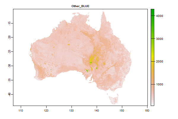
14.5 Gb | Other_BLUE |
Name : Other_BLUE
Description : Barest Earth Landsat Imagery - BLUE
Source : Geoscience Australia
Metadata : https://shiny.esoil.io/Apps/Covariates?Attribute=Other&Name=Other_BLUE&Resolution=30m
Units : none
SCORPAN : Other
Original Resolution : 25m
|
Barest Earth Landsat Imagery - BLUE | MetaData |
 Click to enlarge the image
|
|
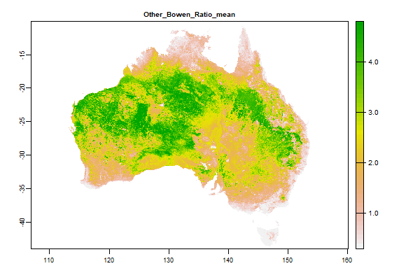
5.5 Gb | Other_Bowen_Ratio_mean |
Name : Other_Bowen_Ratio_mean
Description : Actual Evaporation Modelling - Bowen Ratio - Sensible heat / Latent heat
Source : CSIRO
Metadata : https://shiny.esoil.io/Apps/Covariates?Attribute=Other&Name=Other_Bowen_Ratio_mean&Resolution=30m
Units : mm per day
SCORPAN : Other
Original Resolution : 0.005 Degrees
|
Actual Evaporation Modelling - Bowen Ratio - Sensible heat / Latent heat | MetaData |
 Click to enlarge the image
|
|
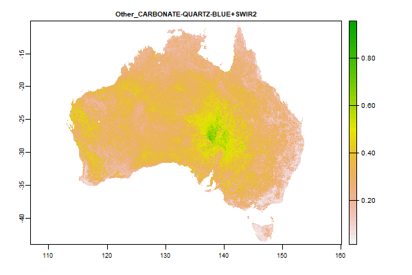
42.9 Gb | Other_CARBONATE-QUARTZ-BLUE+SWIR2 |
Name : Other_CARBONATE-QUARTZ-BLUE+SWIR2
Description : Barest Earth Landsat Imagery - CARBONATE-QUARTZ-BLUE+SWIR2
Source : Geoscience Australia
Metadata : https://shiny.esoil.io/Apps/Covariates?Attribute=Other&Name=Other_CARBONATE-QUARTZ-BLUE+SWIR2&Resolution=30m
Units : none
SCORPAN : Other
Original Resolution : 25m
|
Barest Earth Landsat Imagery - CARBONATE-QUARTZ-BLUE+SWIR2 | MetaData |
 Click to enlarge the image
|
|
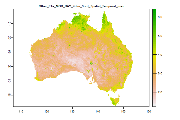
5.5 Gb | Other_ETa_MOD_DAY_4dim_3ord_Spatial_Temporal_max |
Name : Other_ETa_MOD_DAY_4dim_3ord_Spatial_Temporal_max
Description : Actual Evaporation Modelling - Latent heat- Maximum of the temporal monthlytimeseries
Source : CSIRO
Metadata : https://shiny.esoil.io/Apps/Covariates?Attribute=Other&Name=Other_ETa_MOD_DAY_4dim_3ord_Spatial_Temporal_max&Resolution=30m
Units : mm per day
SCORPAN : Other
Original Resolution : 0.005 Degrees
|
Actual Evaporation Modelling - Latent heat- Maximum of the temporal monthlytimeseries | MetaData |
 Click to enlarge the image
|
|
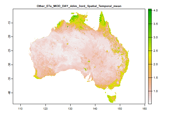
5.5 Gb | Other_ETa_MOD_DAY_4dim_3ord_Spatial_Temporal_mean |
Name : Other_ETa_MOD_DAY_4dim_3ord_Spatial_Temporal_mean
Description : Actual Evaporation Modelling - Latent heat - Mean of the temporal monthly timeseries
Source : CSIRO
Metadata : https://shiny.esoil.io/Apps/Covariates?Attribute=Other&Name=Other_ETa_MOD_DAY_4dim_3ord_Spatial_Temporal_mean&Resolution=30m
Units : mm per day
SCORPAN : Other
Original Resolution : 0.005 Degrees
|
Actual Evaporation Modelling - Latent heat - Mean of the temporal monthly timeseries | MetaData |
 Click to enlarge the image
|
|
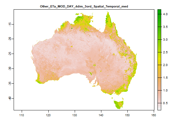
5.6 Gb | Other_ETa_MOD_DAY_4dim_3ord_Spatial_Temporal_med |
Name : Other_ETa_MOD_DAY_4dim_3ord_Spatial_Temporal_med
Description : Actual Evaporation Modelling - Latent heat - Median of the temporal monthly timeseries
Source : CSIRO
Metadata : https://shiny.esoil.io/Apps/Covariates?Attribute=Other&Name=Other_ETa_MOD_DAY_4dim_3ord_Spatial_Temporal_med&Resolution=30m
Units : mm per day
SCORPAN : Other
Original Resolution : 0.005 Degrees
|
Actual Evaporation Modelling - Latent heat - Median of the temporal monthly timeseries | MetaData |
 Click to enlarge the image
|
|
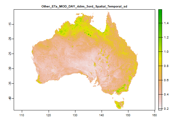
5.4 Gb | Other_ETa_MOD_DAY_4dim_3ord_Spatial_Temporal_sd |
Name : Other_ETa_MOD_DAY_4dim_3ord_Spatial_Temporal_sd
Description : Actual Evaporation Modelling - Latent heat - Standard deviation of the temporal monthly timeseries
Source : CSIRO
Metadata : https://shiny.esoil.io/Apps/Covariates?Attribute=Other&Name=Other_ETa_MOD_DAY_4dim_3ord_Spatial_Temporal_sd&Resolution=30m
Units : mm per day
SCORPAN : Other
Original Resolution : 0.005 Degrees
|
Actual Evaporation Modelling - Latent heat - Standard deviation of the temporal monthly timeseries | MetaData |
 Click to enlarge the image
|
|
44.2 Gb | Other_FERRIC-PC2 |
Name : Other_FERRIC-PC2
Description : Barest Earth Landsat Imagery - FERRIC-PC2
Source : Geoscience Australia
Metadata : https://shiny.esoil.io/Apps/Covariates?Attribute=Other&Name=Other_FERRIC-PC2&Resolution=30m
Units : none
SCORPAN : Other
Original Resolution : 25m
|
Barest Earth Landsat Imagery - FERRIC-PC2 | MetaData |
 Click to enlarge the image
|
|
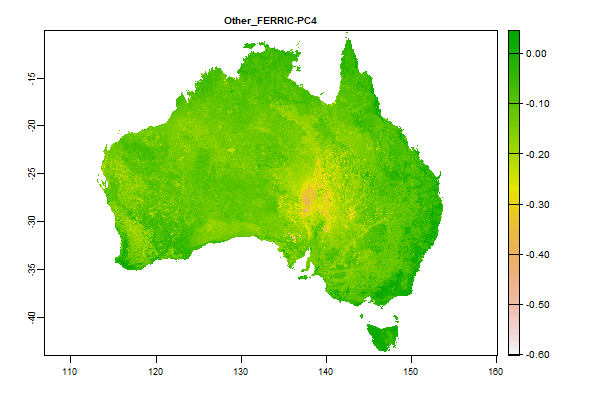
44.9 Gb | Other_FERRIC-PC4 |
Name : Other_FERRIC-PC4
Description : Barest Earth Landsat Imagery - FERRIC-PC4
Source : Geoscience Australia
Metadata : https://shiny.esoil.io/Apps/Covariates?Attribute=Other&Name=Other_FERRIC-PC4&Resolution=30m
Units : none
SCORPAN : Other
Original Resolution : 25m
|
Barest Earth Landsat Imagery - FERRIC-PC4 | MetaData |
 Click to enlarge the image
|
|
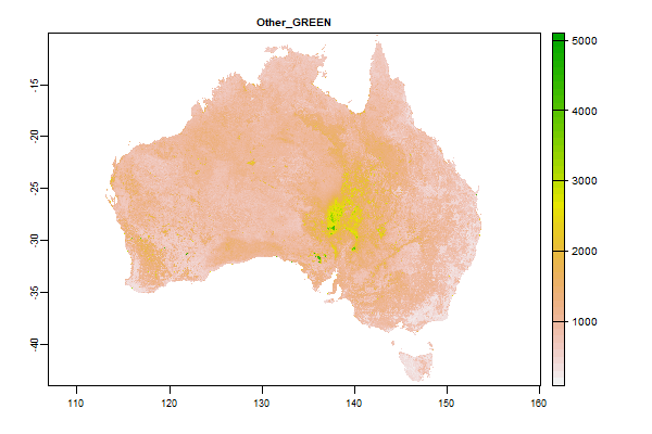
15.9 Gb | Other_GREEN |
Name : Other_GREEN
Description : Barest Earth Landsat Imagery - GREEN
Source : Geoscience Australia
Metadata : https://shiny.esoil.io/Apps/Covariates?Attribute=Other&Name=Other_GREEN&Resolution=30m
Units : none
SCORPAN : Other
Original Resolution : 25m
|
Barest Earth Landsat Imagery - GREEN | MetaData |
 Click to enlarge the image
|
|
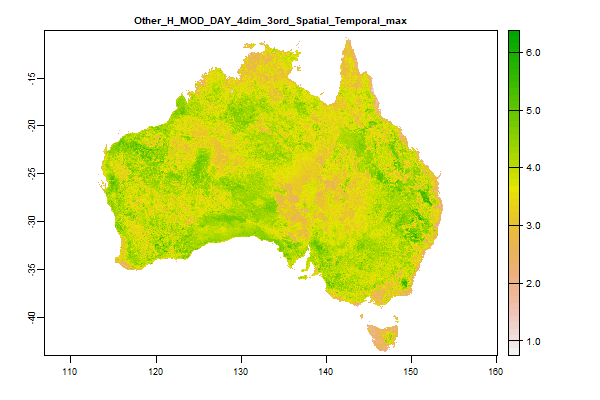
5.4 Gb | Other_H_MOD_DAY_4dim_3ord_Spatial_Temporal_max |
Name : Other_H_MOD_DAY_4dim_3ord_Spatial_Temporal_max
Description : Actual Evaporation Modelling - Sensible heat- Maximum of the temporal monthly timeseries
Source : CSIRO
Metadata : https://shiny.esoil.io/Apps/Covariates?Attribute=Other&Name=Other_H_MOD_DAY_4dim_3ord_Spatial_Temporal_max&Resolution=30m
Units : mm per day
SCORPAN : Other
Original Resolution : 0.005 Degrees
|
Actual Evaporation Modelling - Sensible heat- Maximum of the temporal monthly timeseries | MetaData |
 Click to enlarge the image
|
|
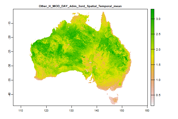
5.5 Gb | Other_H_MOD_DAY_4dim_3ord_Spatial_Temporal_mean |
Name : Other_H_MOD_DAY_4dim_3ord_Spatial_Temporal_mean
Description : Actual Evaporation Modelling - Sensible heat - Mean of the temporal monthly timeseries
Source : CSIRO
Metadata : https://shiny.esoil.io/Apps/Covariates?Attribute=Other&Name=Other_H_MOD_DAY_4dim_3ord_Spatial_Temporal_mean&Resolution=30m
Units : mm per day
SCORPAN : Other
Original Resolution : 0.005 Degrees
|
Actual Evaporation Modelling - Sensible heat - Mean of the temporal monthly timeseries | MetaData |
 Click to enlarge the image
|
|
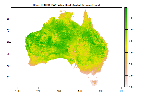
5.5 Gb | Other_H_MOD_DAY_4dim_3ord_Spatial_Temporal_med |
Name : Other_H_MOD_DAY_4dim_3ord_Spatial_Temporal_med
Description : Actual Evaporation Modelling - Sensible heat - Median of the temporal monthly timeseries
Source : CSIRO
Metadata : https://shiny.esoil.io/Apps/Covariates?Attribute=Other&Name=Other_H_MOD_DAY_4dim_3ord_Spatial_Temporal_med&Resolution=30m
Units : mm per day
SCORPAN : Other
Original Resolution : 0.005 Degrees
|
Actual Evaporation Modelling - Sensible heat - Median of the temporal monthly timeseries | MetaData |
 Click to enlarge the image
|
|
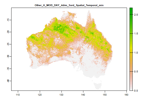
4.7 Gb | Other_H_MOD_DAY_4dim_3ord_Spatial_Temporal_min |
Name : Other_H_MOD_DAY_4dim_3ord_Spatial_Temporal_min
Description : Actual Evaporation Modelling - Sensible heat - Minimum of the temporal monthly timeseries
Source : CSIRO
Metadata : https://shiny.esoil.io/Apps/Covariates?Attribute=Other&Name=Other_H_MOD_DAY_4dim_3ord_Spatial_Temporal_min&Resolution=30m
Units : mm per day
SCORPAN : Other
Original Resolution : 0.005 Degrees
|
Actual Evaporation Modelling - Sensible heat - Minimum of the temporal monthly timeseries | MetaData |
 Click to enlarge the image
|
|
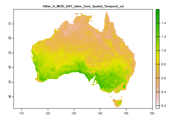
5.2 Gb | Other_H_MOD_DAY_4dim_3ord_Spatial_Temporal_sd |
Name : Other_H_MOD_DAY_4dim_3ord_Spatial_Temporal_sd
Description : Actual Evaporation Modelling - Sensible heat - Standard deviation of the temporal monthly timeseries
Source : CSIRO
Metadata : https://shiny.esoil.io/Apps/Covariates?Attribute=Other&Name=Other_H_MOD_DAY_4dim_3ord_Spatial_Temporal_sd&Resolution=30m
Units : mm per day
SCORPAN : Other
Original Resolution : 0.005 Degrees
|
Actual Evaporation Modelling - Sensible heat - Standard deviation of the temporal monthly timeseries | MetaData |
 Click to enlarge the image
|
|
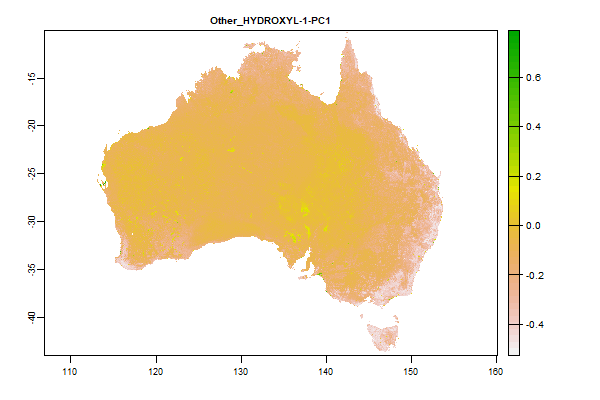
45.3 Gb | Other_HYDROXYL-1-PC1 |
Name : Other_HYDROXYL-1-PC1
Description : Barest Earth Landsat Imagery - HYDROXYL-1-PC1
Source : Geoscience Australia
Metadata : https://shiny.esoil.io/Apps/Covariates?Attribute=Other&Name=Other_HYDROXYL-1-PC1&Resolution=30m
Units : none
SCORPAN : Other
Original Resolution : 25m
|
Barest Earth Landsat Imagery - HYDROXYL-1-PC1 | MetaData |
 Click to enlarge the image
|
|
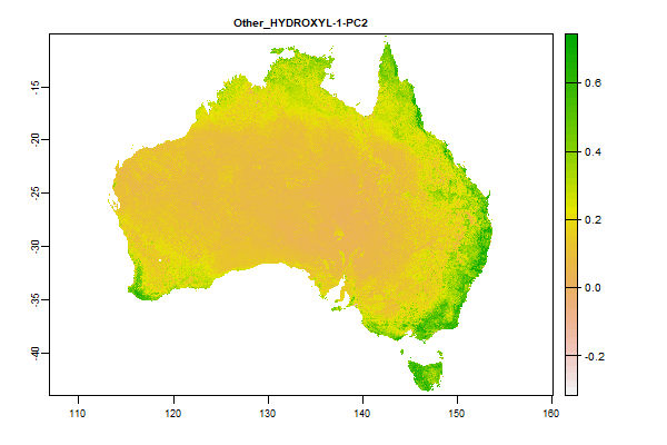
44.7 Gb | Other_HYDROXYL-1-PC2 |
Name : Other_HYDROXYL-1-PC2
Description : Barest Earth Landsat Imagery - HYDROXYL-1-PC2
Source : Geoscience Australia
Metadata : https://shiny.esoil.io/Apps/Covariates?Attribute=Other&Name=Other_HYDROXYL-1-PC2&Resolution=30m
Units : none
SCORPAN : Other
Original Resolution : 25m
|
Barest Earth Landsat Imagery - HYDROXYL-1-PC2 | MetaData |
 Click to enlarge the image
|
|
44 Gb | Other_HYDROXYL-2-PC2 |
Name : Other_HYDROXYL-2-PC2
Description : Barest Earth Landsat Imagery - HYDROXYL-2-PC2
Source : Geoscience Australia
Metadata : https://shiny.esoil.io/Apps/Covariates?Attribute=Other&Name=Other_HYDROXYL-2-PC2&Resolution=30m
Units : none
SCORPAN : Other
Original Resolution : 25m
|
Barest Earth Landsat Imagery - HYDROXYL-2-PC2 | MetaData |
 Click to enlarge the image
|
|
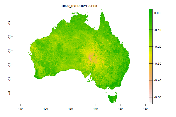
44.3 Gb | Other_HYDROXYL-3-PC3 |
Name : Other_HYDROXYL-3-PC3
Description : Barest Earth Landsat Imagery - HYDROXYL-3-PC3
Source : Geoscience Australia
Metadata : https://shiny.esoil.io/Apps/Covariates?Attribute=Other&Name=Other_HYDROXYL-3-PC3&Resolution=30m
Units : none
SCORPAN : Other
Original Resolution : 25m
|
Barest Earth Landsat Imagery - HYDROXYL-3-PC3 | MetaData |
 Click to enlarge the image
|
|
48 Gb | Other_HYDROXYL-3-PC4 |
Name : Other_HYDROXYL-3-PC4
Description : Barest Earth Landsat Imagery - HYDROXYL-3-PC4
Source : Geoscience Australia
Metadata : https://shiny.esoil.io/Apps/Covariates?Attribute=Other&Name=Other_HYDROXYL-3-PC4&Resolution=30m
Units : none
SCORPAN : Other
Original Resolution : 25m
|
Barest Earth Landsat Imagery - HYDROXYL-3-PC4 | MetaData |
 Click to enlarge the image
|
|
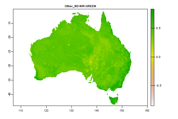
41.1 Gb | Other_ND-NIR-GREEN |
Name : Other_ND-NIR-GREEN
Description : Barest Earth Landsat Imagery - ND-NIR-GREEN
Source : Geoscience Australia
Metadata : https://shiny.esoil.io/Apps/Covariates?Attribute=Other&Name=Other_ND-NIR-GREEN&Resolution=30m
Units : none
SCORPAN : Other
Original Resolution : 25m
|
Barest Earth Landsat Imagery - ND-NIR-GREEN | MetaData |
 Click to enlarge the image
|
|
41.7 Gb | Other_ND-RED-BLUE |
Name : Other_ND-RED-BLUE
Description : Barest Earth Landsat Imagery - ND-RED-BLUE
Source : Geoscience Australia
Metadata : https://shiny.esoil.io/Apps/Covariates?Attribute=Other&Name=Other_ND-RED-BLUE&Resolution=30m
Units : none
SCORPAN : Other
Original Resolution : 25m
|
Barest Earth Landsat Imagery - ND-RED-BLUE | MetaData |
 Click to enlarge the image
|
|
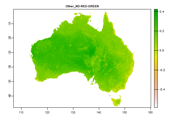
43.4 Gb | Other_ND-RED-GREEN |
Name : Other_ND-RED-GREEN
Description : Barest Earth Landsat Imagery - ND-RED-GREEN
Source : Geoscience Australia
Metadata : https://shiny.esoil.io/Apps/Covariates?Attribute=Other&Name=Other_ND-RED-GREEN&Resolution=30m
Units : none
SCORPAN : Other
Original Resolution : 25m
|
Barest Earth Landsat Imagery - ND-RED-GREEN | MetaData |
 Click to enlarge the image
|
|
38.7 Gb | Other_ND-SWIR1-BLUE |
Name : Other_ND-SWIR1-BLUE
Description : Barest Earth Landsat Imagery - ND-SWIR1-BLUE
Source : Geoscience Australia
Metadata : https://shiny.esoil.io/Apps/Covariates?Attribute=Other&Name=Other_ND-SWIR1-BLUE&Resolution=30m
Units : none
SCORPAN : Other
Original Resolution : 25m
|
Barest Earth Landsat Imagery - ND-SWIR1-BLUE | MetaData |
 Click to enlarge the image
|
|
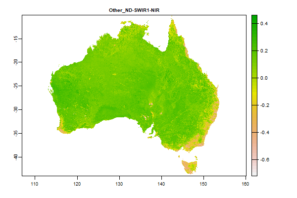
45.6 Gb | Other_ND-SWIR1-NIR |
Name : Other_ND-SWIR1-NIR
Description : Barest Earth Landsat Imagery - ND-SWIR1-NIR
Source : Geoscience Australia
Metadata : https://shiny.esoil.io/Apps/Covariates?Attribute=Other&Name=Other_ND-SWIR1-NIR&Resolution=30m
Units : none
SCORPAN : Other
Original Resolution : 25m
|
Barest Earth Landsat Imagery - ND-SWIR1-NIR | MetaData |
 Click to enlarge the image
|
|
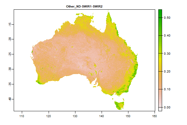
43.7 Gb | Other_ND-SWIR1-SWIR2 |
Name : Other_ND-SWIR1-SWIR2
Description : Barest Earth Landsat Imagery - ND-SWIR1-SWIR2
Source : Geoscience Australia
Metadata : https://shiny.esoil.io/Apps/Covariates?Attribute=Other&Name=Other_ND-SWIR1-SWIR2&Resolution=30m
Units : none
SCORPAN : Other
Original Resolution : 25m
|
Barest Earth Landsat Imagery - ND-SWIR1-SWIR2 | MetaData |
 Click to enlarge the image
|
|
42.1 Gb | Other_ND-SWIR2-GREEN |
Name : Other_ND-SWIR2-GREEN
Description : Barest Earth Landsat Imagery - ND-SWIR2-GREEN
Source : Geoscience Australia
Metadata : https://shiny.esoil.io/Apps/Covariates?Attribute=Other&Name=Other_ND-SWIR2-GREEN&Resolution=30m
Units : none
SCORPAN : Other
Original Resolution : 25m
|
Barest Earth Landsat Imagery - ND-SWIR2-GREEN | MetaData |
 Click to enlarge the image
|
|
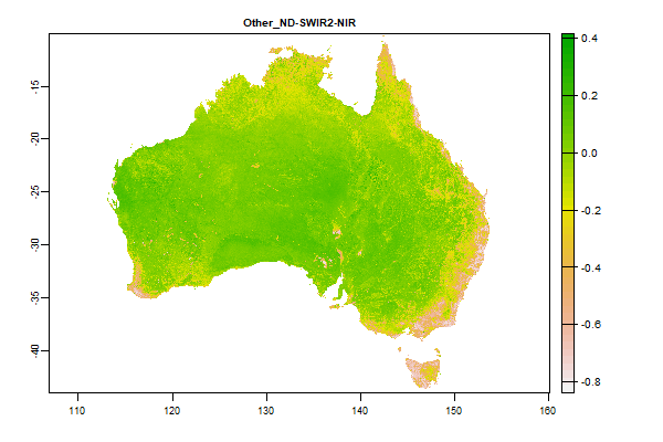
48.4 Gb | Other_ND-SWIR2-NIR |
Name : Other_ND-SWIR2-NIR
Description : Barest Earth Landsat Imagery - ND-SWIR2-NIR
Source : Geoscience Australia
Metadata : https://shiny.esoil.io/Apps/Covariates?Attribute=Other&Name=Other_ND-SWIR2-NIR&Resolution=30m
Units : none
SCORPAN : Other
Original Resolution : 25m
|
Barest Earth Landsat Imagery - ND-SWIR2-NIR | MetaData |
 Click to enlarge the image
|
|
42 Gb | Other_ND-SWIR2-RED |
Name : Other_ND-SWIR2-RED
Description : Barest Earth Landsat Imagery - ND-SWIR2-RED
Source : Geoscience Australia
Metadata : https://shiny.esoil.io/Apps/Covariates?Attribute=Other&Name=Other_ND-SWIR2-RED&Resolution=30m
Units : none
SCORPAN : Other
Original Resolution : 25m
|
Barest Earth Landsat Imagery - ND-SWIR2-RED | MetaData |
 Click to enlarge the image
|
|
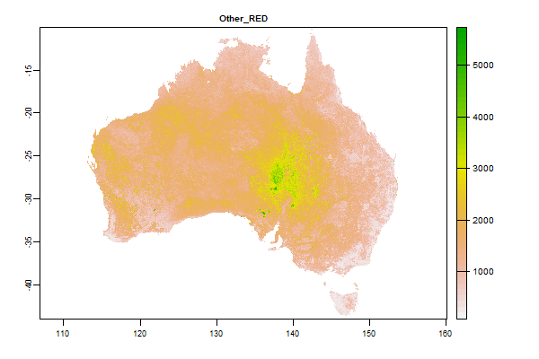
18 Gb | Other_RED |
Name : Other_RED
Description : Barest Earth Landsat Imagery - RED
Source : Geoscience Australia
Metadata : https://shiny.esoil.io/Apps/Covariates?Attribute=Other&Name=Other_RED&Resolution=30m
Units : none
SCORPAN : Other
Original Resolution : 25m
|
Barest Earth Landsat Imagery - RED | MetaData |
 Click to enlarge the image
|
|
19.6 Gb | Other_SWIR1 |
Name : Other_SWIR1
Description : Barest Earth Landsat Imagery - SWIR1
Source : Geoscience Australia
Metadata : https://shiny.esoil.io/Apps/Covariates?Attribute=Other&Name=Other_SWIR1&Resolution=30m
Units : none
SCORPAN : Other
Original Resolution : 25m
|
Barest Earth Landsat Imagery - SWIR1 | MetaData |
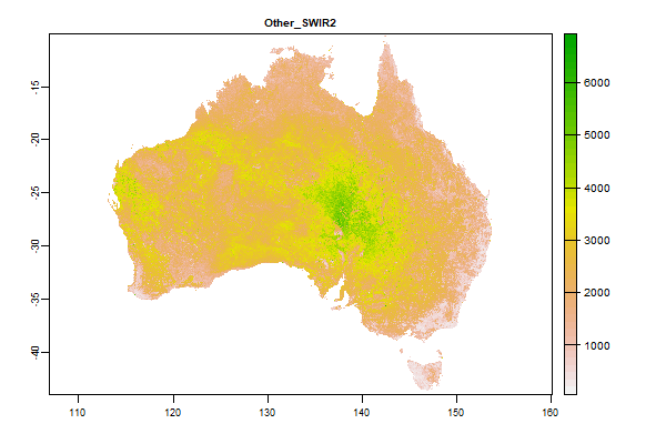 Click to enlarge the image
|
|
19.8 Gb | Other_SWIR2 |
Name : Other_SWIR2
Description : Barest Earth Landsat Imagery - SWIR2
Source : Geoscience Australia
Metadata : https://shiny.esoil.io/Apps/Covariates?Attribute=Other&Name=Other_SWIR2&Resolution=30m
Units : none
SCORPAN : Other
Original Resolution : 25m
|
Barest Earth Landsat Imagery - SWIR2 | MetaData |
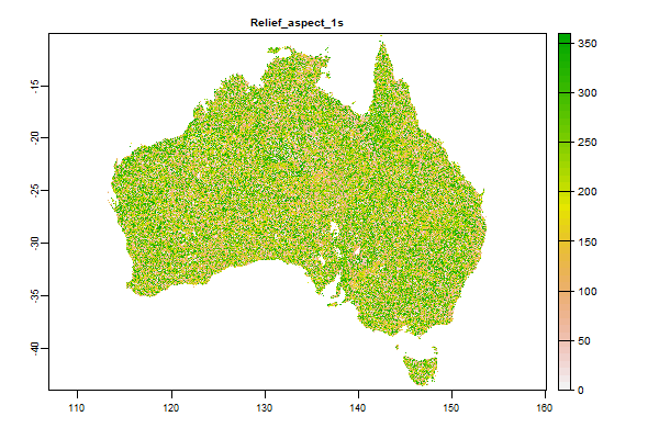 Click to enlarge the image
|
|
47.7 Gb | Relief_aspect_1s |
Name : Relief_aspect_1s
Description : Aspect derived from 1" SRTM DEM-S
Source : CSIRO
Metadata : https://shiny.esoil.io/Apps/Covariates?Attribute=Relief&Name=Relief_aspect_1s&Resolution=30m
Units : none
SCORPAN : Relief
Original Resolution : 1 arc-second
|
Aspect derived from 1" SRTM DEM-S | MetaData |
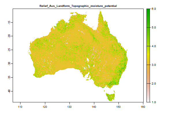 Click to enlarge the image
|
|
1.2 Gb | Relief_Aus_Landform_Topographic_moisture_potential |
Name : Relief_Aus_Landform_Topographic_moisture_potential
Description : GEOSS Ecosystem Mapping for Australia - Topographic Moisture Potential
Source : TERN
Metadata : https://shiny.esoil.io/Apps/Covariates?Attribute=Relief&Name=Relief_Aus_Landform_Topographic_moisture_potential&Resolution=30m
Units : none
SCORPAN : Relief
Original Resolution : 90m
|
GEOSS Ecosystem Mapping for Australia - Topographic Moisture Potential | MetaData |
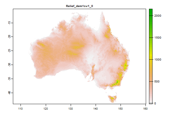 Click to enlarge the image
|
|
28.3 Gb | Relief_dem1sv1_0 |
Name : Relief_dem1sv1_0
Description : SRTM-derived 1 Second Digital Elevation Models Version 1.0
Source : CSIRO
Metadata : https://shiny.esoil.io/Apps/Covariates?Attribute=Relief&Name=Relief_dem1sv1_0&Resolution=30m
Units : none
SCORPAN : Relief
Original Resolution : 1 arc-second
|
SRTM-derived 1 Second Digital Elevation Models Version 1.0 | MetaData |
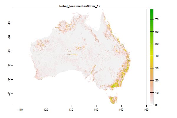 Click to enlarge the image
|
|
41.4 Gb | Relief_focalmedian300m_1s |
Name : Relief_focalmedian300m_1s
Description : Median of Percent Slope over 300 m derived from 1" SRTM DEM-S
Source : CSIRO
Metadata : https://shiny.esoil.io/Apps/Covariates?Attribute=Relief&Name=Relief_focalmedian300m_1s&Resolution=30m
Units : none
SCORPAN : Relief
Original Resolution : 1 arc-second
|
Median of Percent Slope over 300 m derived from 1" SRTM DEM-S | MetaData |
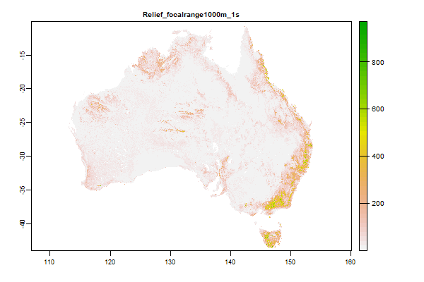 Click to enlarge the image
|
|
25.3 Gb | Relief_focalrange1000m_1s |
Name : Relief_focalrange1000m_1s
Description : Relief - Elevation Range over 1000 m derived from 1" SRTM DEM-S
Source : CSIRO
Metadata : https://shiny.esoil.io/Apps/Covariates?Attribute=Relief&Name=Relief_focalrange1000m_1s&Resolution=30m
Units : none
SCORPAN : Relief
Original Resolution : 1 arc-second
|
Relief - Elevation Range over 1000 m derived from 1" SRTM DEM-S | MetaData |
 Click to enlarge the image
|
|
32.3 Gb | Relief_focalrange300m_1s |
Name : Relief_focalrange300m_1s
Description : Relief - Elevation Range over 300 m derived from 1" SRTM DEM-S
Source : CSIRO
Metadata : https://shiny.esoil.io/Apps/Covariates?Attribute=Relief&Name=Relief_focalrange300m_1s&Resolution=30m
Units : none
SCORPAN : Relief
Original Resolution : 1 arc-second
|
Relief - Elevation Range over 300 m derived from 1" SRTM DEM-S | MetaData |
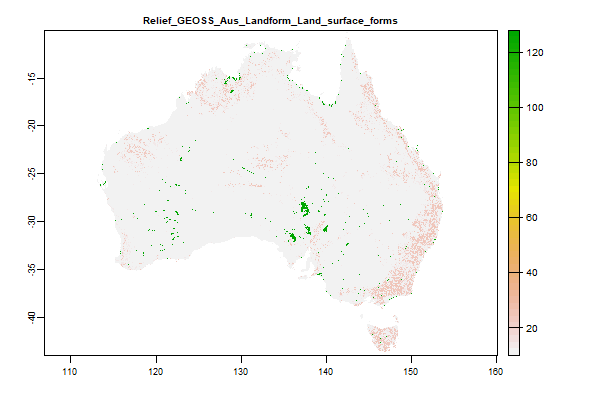 Click to enlarge the image
|
|
894.2 Mb | Relief_GEOSS_Aus_Landform_Land_surface_forms |
Name : Relief_GEOSS_Aus_Landform_Land_surface_forms
Description : GEOSS Ecosystem Mapping for Australia - Land Surface Forms
Source : TERN
Metadata : https://shiny.esoil.io/Apps/Covariates?Attribute=Relief&Name=Relief_GEOSS_Aus_Landform_Land_surface_forms&Resolution=30m
Units : none
SCORPAN : Relief
Original Resolution : 90m
|
GEOSS Ecosystem Mapping for Australia - Land Surface Forms | MetaData |
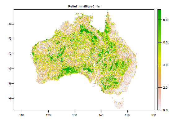 Click to enlarge the image
|
|
29.5 Gb | Relief_mrrtf6g-a5_1s |
Name : Relief_mrrtf6g-a5_1s
Description : Multi-resolution Ridge Top Flatness (MrRTF)
Source : CSIRO
Metadata : https://shiny.esoil.io/Apps/Covariates?Attribute=Relief&Name=Relief_mrrtf6g-a5_1s&Resolution=30m
Units : none
SCORPAN : Relief
Original Resolution : 1 arc-second
|
Multi-resolution Ridge Top Flatness (MrRTF) | MetaData |
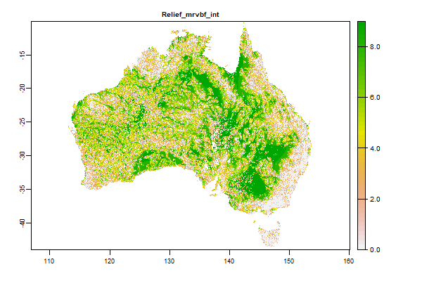 Click to enlarge the image
|
|
2.7 Gb | Relief_mrvbf_int |
Name : Relief_mrvbf_int
Description : Multi-resolution Valley Bottom Flatness (MrVBF)
Source : CSIRO
Metadata : https://shiny.esoil.io/Apps/Covariates?Attribute=Relief&Name=Relief_mrvbf_int&Resolution=30m
Units : none
SCORPAN : Relief
Original Resolution : 1 arc-second
|
Multi-resolution Valley Bottom Flatness (MrVBF) | MetaData |
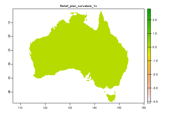 Click to enlarge the image
|
|
53.5 Gb | Relief_plan_curvature_1s |
Name : Relief_plan_curvature_1s
Description : Plan Curvature derived from 1" SRTM DEM-S
Source : CSIRO
Metadata : https://shiny.esoil.io/Apps/Covariates?Attribute=Relief&Name=Relief_plan_curvature_1s&Resolution=30m
Units : none
SCORPAN : Relief
Original Resolution : 1 arc-second
|
Plan Curvature derived from 1" SRTM DEM-S | MetaData |
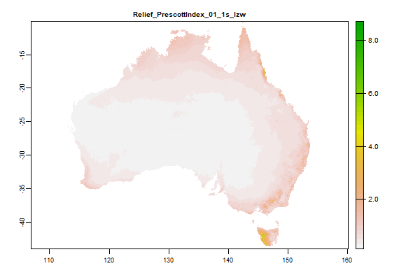 Click to enlarge the image
|
|
33.9 Gb | Relief_PrescottIndex_01_1s_lzw |
Name : Relief_PrescottIndex_01_1s_lzw
Description : Prescott Index derived from 1" SRTM DEM-S
Source : CSIRO
Metadata : https://shiny.esoil.io/Apps/Covariates?Attribute=Relief&Name=Relief_PrescottIndex_01_1s_lzw&Resolution=30m
Units : none
SCORPAN : Relief
Original Resolution : 1 arc-second
|
Prescott Index derived from 1" SRTM DEM-S | MetaData |
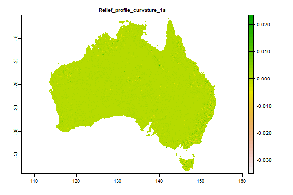 Click to enlarge the image
|
|
53.1 Gb | Relief_profile_curvature_1s |
Name : Relief_profile_curvature_1s
Description : Profile Curvature derived from 1" SRTM DEM-S
Source : CSIRO
Metadata : https://shiny.esoil.io/Apps/Covariates?Attribute=Relief&Name=Relief_profile_curvature_1s&Resolution=30m
Units : none
SCORPAN : Relief
Original Resolution : 1 arc-second
|
Profile Curvature derived from 1" SRTM DEM-S | MetaData |
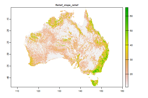 Click to enlarge the image
|
|
1.2 Gb | Relief_slope_relief |
Name : Relief_slope_relief
Description : Slope Relief Classification derived from 1" SRTM DEM-S
Source : CSIRO
Metadata : https://shiny.esoil.io/Apps/Covariates?Attribute=Relief&Name=Relief_slope_relief&Resolution=30m
Units : none
SCORPAN : Relief
Original Resolution : 1 arc-second
|
Slope Relief Classification derived from 1" SRTM DEM-S | MetaData |
 Click to enlarge the image
|
|
48.8 Gb | Relief_slopedeg_1s |
Name : Relief_slopedeg_1s
Description : Slope derived from 1" SRTM DEM-S
Source : CSIRO
Metadata : https://shiny.esoil.io/Apps/Covariates?Attribute=Relief&Name=Relief_slopedeg_1s&Resolution=30m
Units : none
SCORPAN : Relief
Original Resolution : 1 arc-second
|
Slope derived from 1" SRTM DEM-S | MetaData |
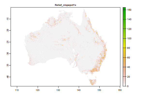 Click to enlarge the image
|
|
48.8 Gb | Relief_slopepct1s |
Name : Relief_slopepct1s
Description : Slope derived from 1" SRTM DEM-S
Source : CSIRO
Metadata : https://shiny.esoil.io/Apps/Covariates?Attribute=Relief&Name=Relief_slopepct1s&Resolution=30m
Units : none
SCORPAN : Relief
Original Resolution : 1 arc-second
|
Slope derived from 1" SRTM DEM-S | MetaData |
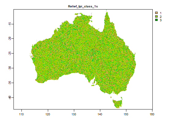 Click to enlarge the image
|
|
2.8 Gb | Relief_tpi_class_1s |
Name : Relief_tpi_class_1s
Description : Topographic Position Index derived from 1" SRTM DEM-S
Source : CSIRO
Metadata : https://shiny.esoil.io/Apps/Covariates?Attribute=Relief&Name=Relief_tpi_class_1s&Resolution=30m
Units : none
SCORPAN : Relief
Original Resolution : 1 arc-second
|
Topographic Position Index derived from 1" SRTM DEM-S | MetaData |
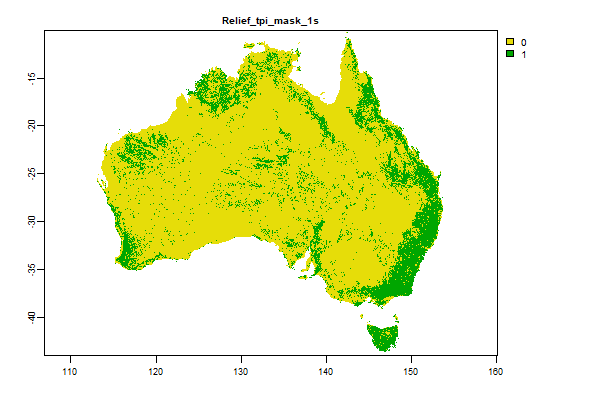 Click to enlarge the image
|
|
621.9 Mb | Relief_tpi_mask_1s |
Name : Relief_tpi_mask_1s
Description : Topographic Position Index derived from 1" SRTM DEM-S
Source : CSIRO
Metadata : https://shiny.esoil.io/Apps/Covariates?Attribute=Relief&Name=Relief_tpi_mask_1s&Resolution=30m
Units : none
SCORPAN : Relief
Original Resolution : 1 arc-second
|
Topographic Position Index derived from 1" SRTM DEM-S | MetaData |
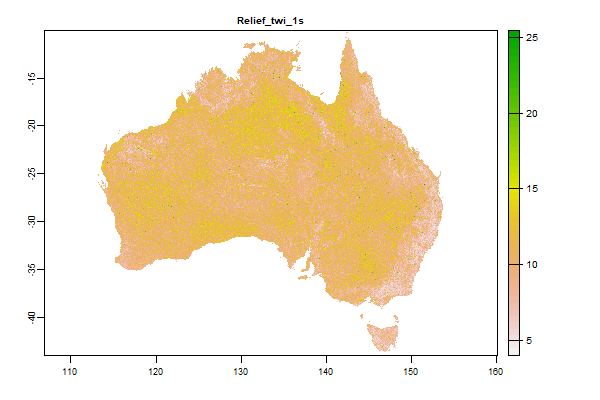 Click to enlarge the image
|
|
43.9 Gb | Relief_twi_1s |
Name : Relief_twi_1s
Description : Topographic Wetness Index derived from 1" SRTM DEM-H
Source : CSIRO
Metadata : https://shiny.esoil.io/Apps/Covariates?Attribute=Relief&Name=Relief_twi_1s&Resolution=30m
Units : none
SCORPAN : Relief
Original Resolution : 1 arc-second
|
Topographic Wetness Index derived from 1" SRTM DEM-H | MetaData |
FundersPartners


TERN is enabled by NCRIS.